
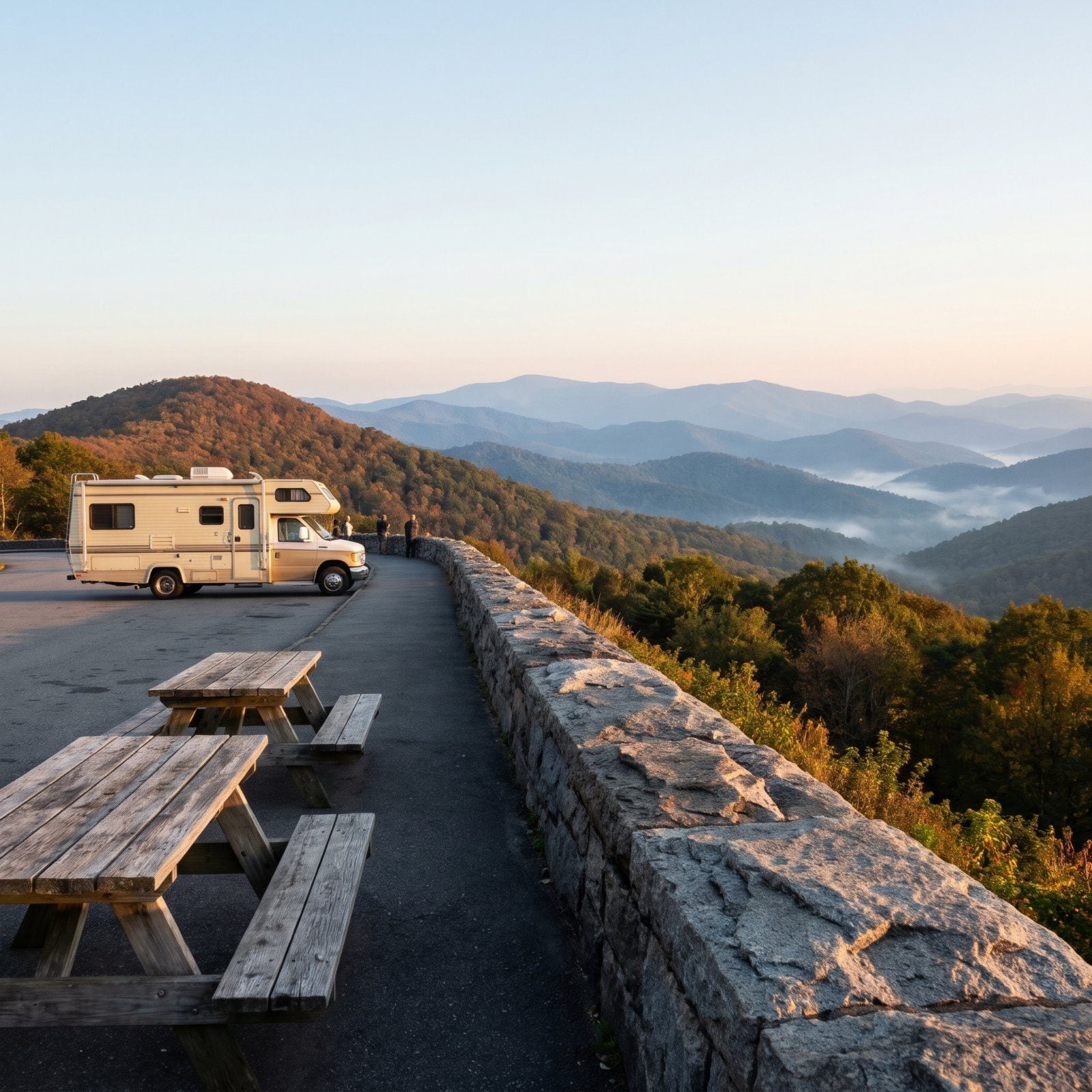
The scariest thing on the Blue Ridge Parkway isn’t a hairpin or a bear. It’s a tunnel carved for 1930s cars, waiting on your 12-foot rig with no shoulder to turn around. Most of the Parkway’s tunnels sit in North Carolina, and a couple near Cherokee drop to 11 feet 7 inches at the edge line. So the real question isn’t which overlook has the best view. It’s which views you can actually reach without white-knuckling it, where the lot holds a motorhome, and which climb is worth the knees. These stops answer that.
Please note that some of the images in this article were created with the assistance of AI.
18. Waterrock Knob Overlook (Milepost 451.2)
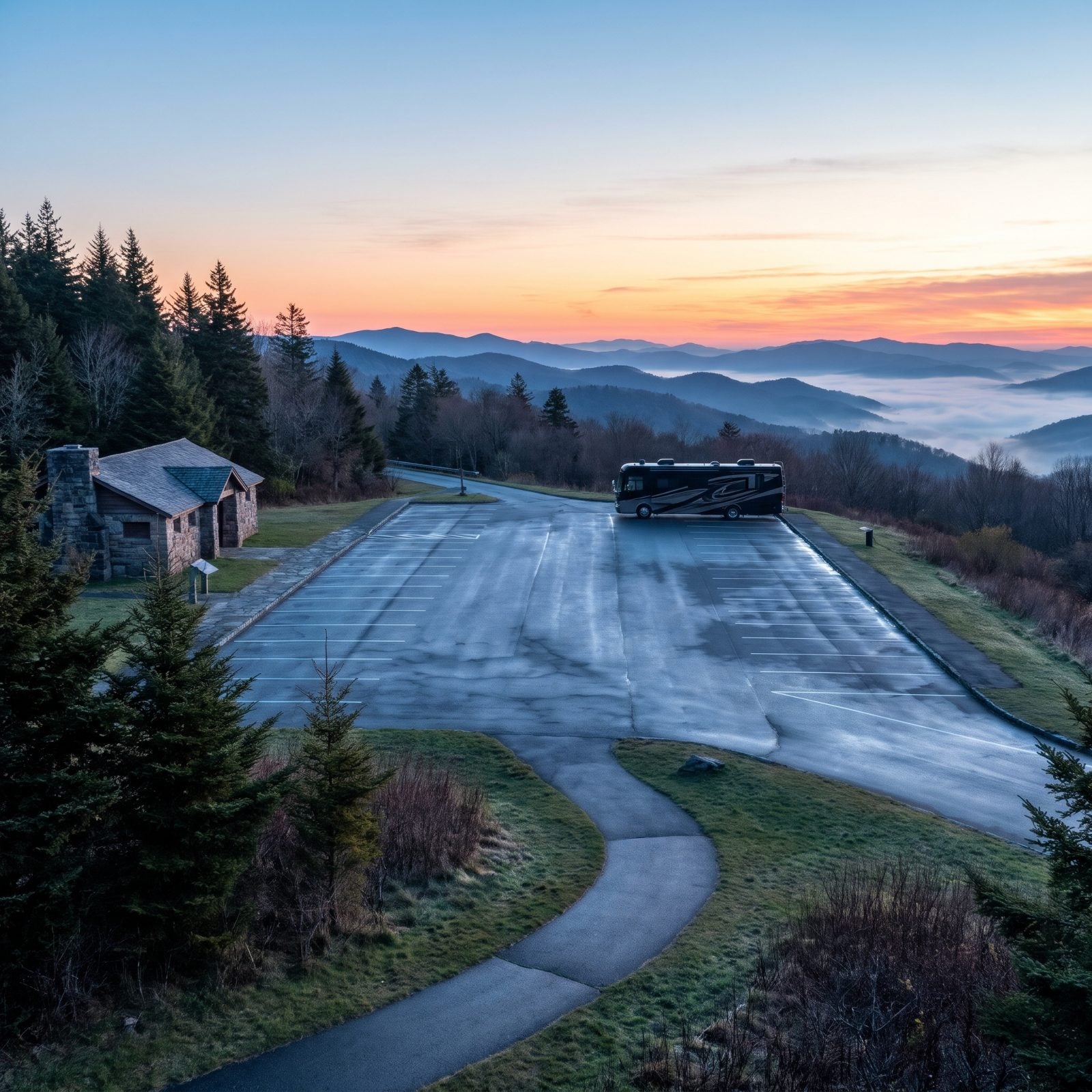
One of the highest stops on the whole Parkway, and it earns the ranking. The visitor center sits at 5,820 feet, the summit higher still, and a couple of sources quibble over the exact number — honestly nobody’s dragging a survey crew up to settle it. What makes this a top pick for big rigs is the lot: wide, open, with NPS-listed bus and RV parking, seasonal restrooms, water, and picnic tables.
Routing is the gift here. No tunnels between Balsam Gap and the overlook, so you can roll up without holding your breath. The summit trail runs about a mile round trip and gains a few hundred feet. The first two-tenths of a mile is paved and easy. Then it turns into steep dirt and rock that’ll find out how your knees are doing.
17. Richland Balsam Overlook (Milepost 431.4)
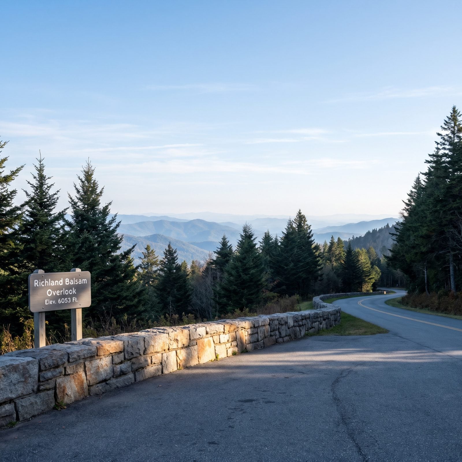
This is the top of the road itself. At 6,053 feet, no stretch of Parkway asphalt climbs higher, and the sign makes a point of telling you so.
About a third of a mile away at Haywood-Jackson Overlook, a 1.5-mile loop pushes through spruce-fir to the 6,410-foot summit of Richland Balsam, one of the highest summits you can hike to from the Parkway. The air smells like Christmas trees up there, which never gets old.
For routing, come in from NC 215 at Beech Gap, head south, and you’ll hit no tunnels before the overlook. Approach from the south out of Balsam Gap and you’ll thread Pinnacle Ridge Tunnel at 13 feet 7 inches on the edge line. Measure your rig twice.
16. Craggy Dome and Craggy Gardens (Milepost 364.1)
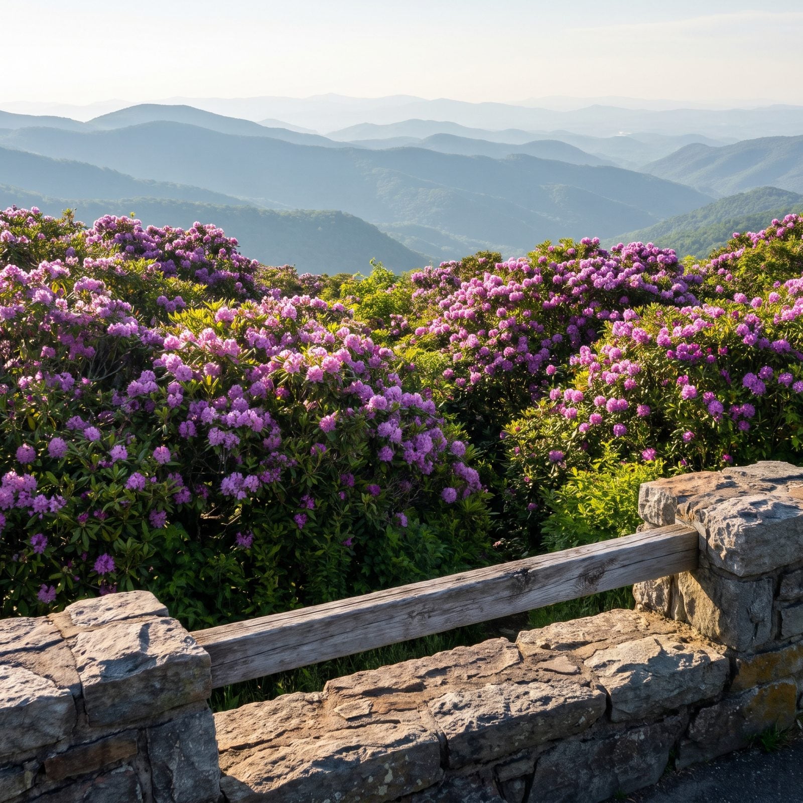
Come in June or July and this is a different planet. The heath balds light up with Catawba rhododendron, deep magenta against the blue ridges, and photographers lose their minds over it.
Craggy Dome’s view sits at Milepost 364.1, Craggy Gardens at 364.6, both back open after the long stretch from Asheville to Ridge Junction reopened in September 2025 following Helene repairs. The visitor center and the Craggy Pinnacle Trail are running again. The picnic area still isn’t, so plan your lunch elsewhere.
15. Rough Ridge Overlook (Milepost 302.8)
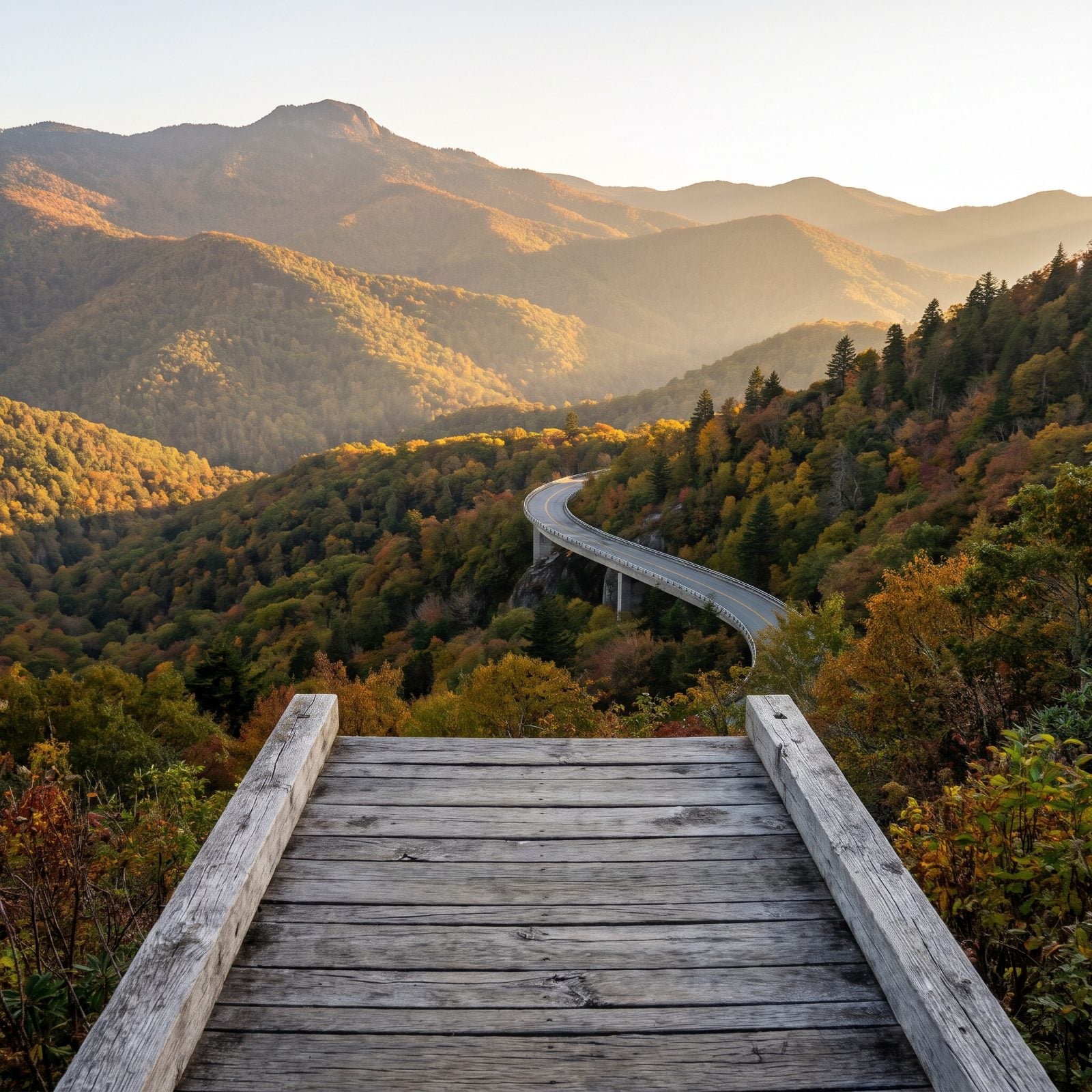
The one everybody photographs. A short uphill spur off the Tanawha Trail leads to boardwalk viewpoints staring straight at Grandfather Mountain and the curving Linn Cove Viaduct at Milepost 304.4. If you’ve seen one famous Parkway shot, it’s probably this.
Leave the dog in the rig. Pets aren’t allowed on this stretch of the Tanawha Trail, which protects fragile habitat. Nearby Stack Rock parking at 304.8 (4,286 feet) has little view of its own, but a short walk on the Tanawha Trail reaches the Stack Rock formation if you want a quieter stop.
14. Devil’s Courthouse Overlook (Milepost 422.4)
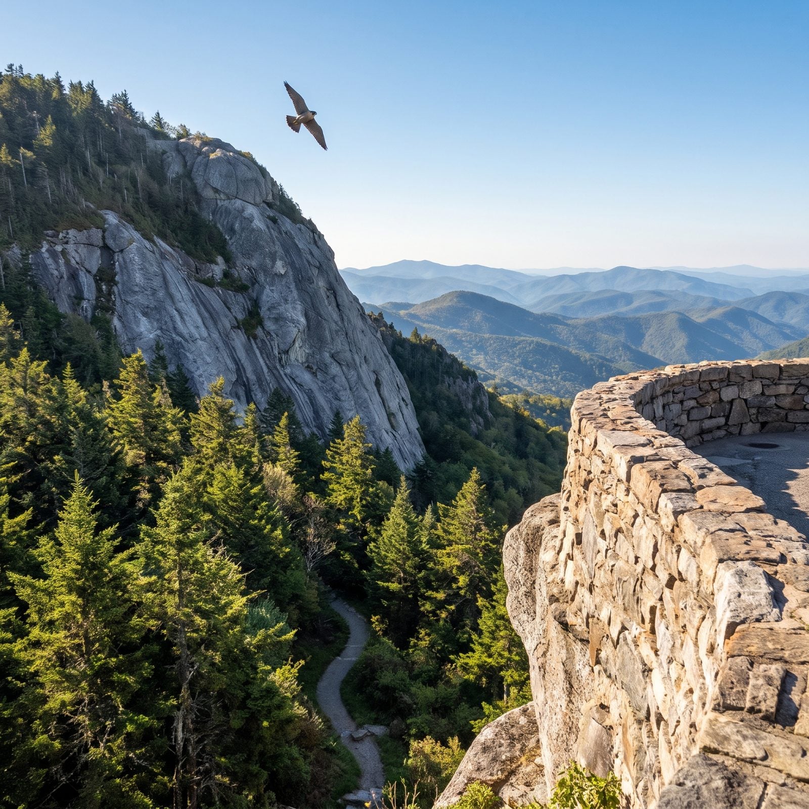
A half-mile trail climbs to a stone-walled platform on a 5,720-foot rock outcrop. From up there you get Shining Rock Wilderness to the west, the Piedmont to the east, and a crag loaded with Cherokee legend and old settler lore.
Watch the sky. Peregrine falcons regularly hunt from this cliff, folding into dives that’ll make you forget the view for a second.
Routing’s friendly from the south: head north from NC 215 and you reach the overlook before the Devil’s Courthouse Tunnel, which runs a comfortable 14 feet 2 inches at the edge line. Roomy by Parkway standards, so this is one taller rigs can usually manage.
13. Chestoa View Overlook (Milepost 320.8)
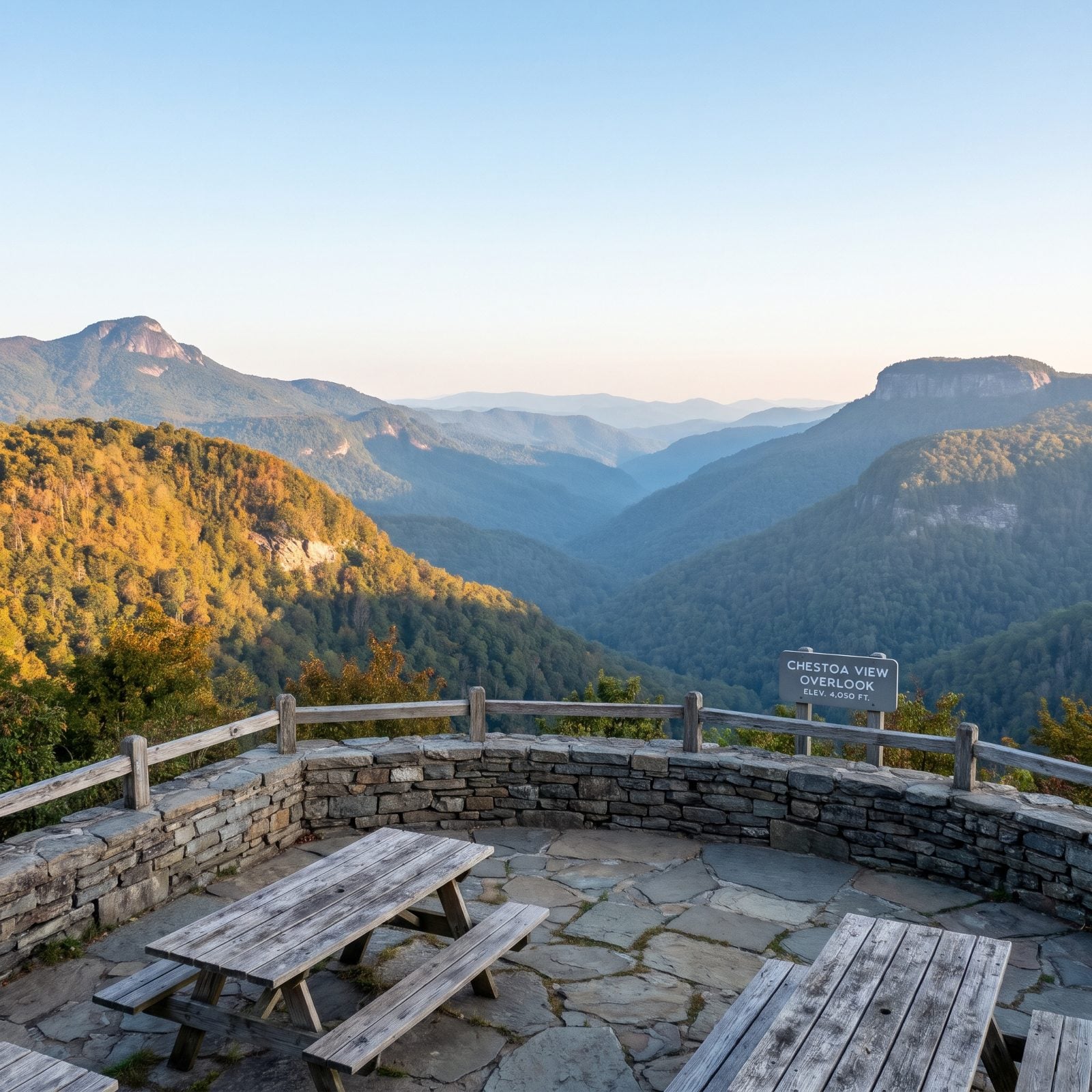
An underrated stop. A quarter-mile walk gets you to a rock-walled viewpoint over Linville Gorge, Grandfather Mountain on your left and Table Rock standing flat on your right. There’s an easy 0.6-mile loop too if you want a little more, past fresh angles on Table Rock.
The parking area has picnic tables, which makes it a solid lunch stop. This section (MP 317.5 to 324.7) reopened in October 2026 after Helene repairs, so it’s freshly back in play.
12. Looking Glass Rock Overlook (Milepost 417)
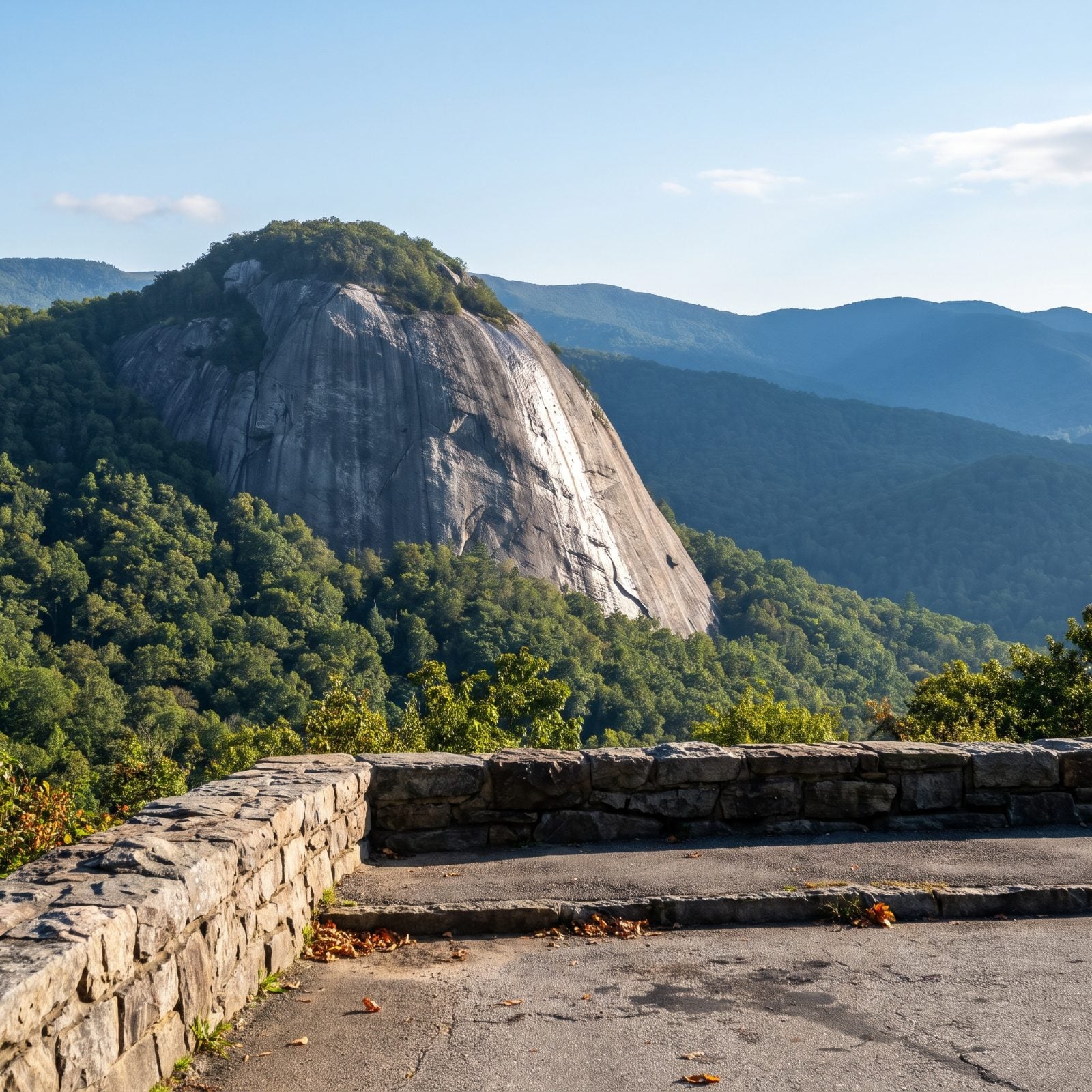
Looking Glass Rock gets its name from the way winter ice and seeping water make the granite face shine like a mirror. From this overlook you stare right at that sheer wall, one of North Carolina’s most famous climbing crags, rising up out of Pisgah National Forest.
Explore Brevard ranks it among the best of the dozen Transylvania County overlooks between MP 406.9 and 423.5. Come south from US 276 at Milepost 411.9 and you reach it through zero tunnels on the NPS list. Easy miles, big payoff.
11. Cowee Mountains Overlook (Milepost 430.7)
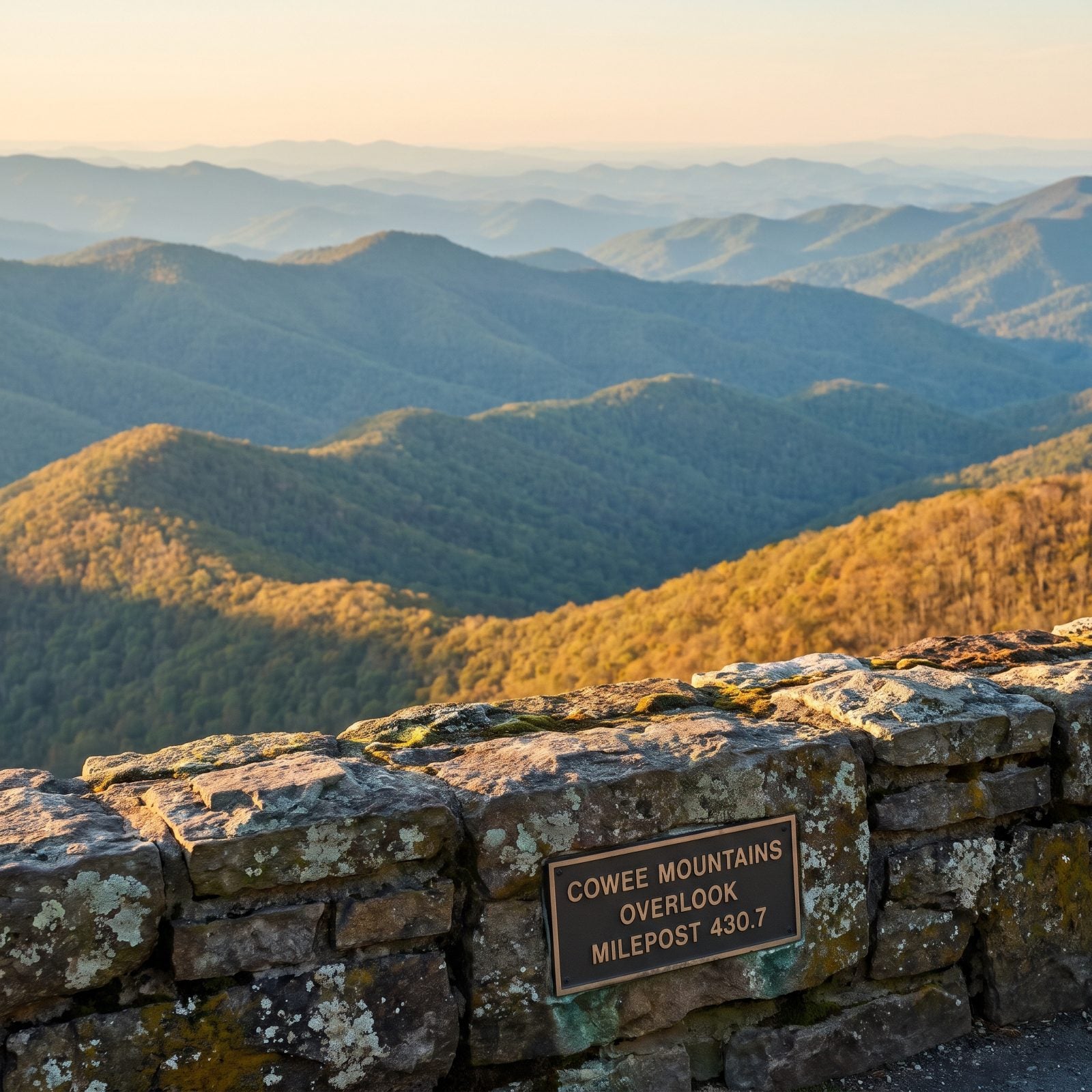
Less than a mile from Richland Balsam. If your idea of the perfect Parkway view is ridgeline stacked on ridgeline with nothing man-made in the frame, this is your stop — layer after layer of undeveloped mountains running clean to the horizon.
The Blue Ridge Parkway Foundation puts it on its shortlist of the best views in North Carolina, and at sunset the layers separate into distinct bands of blue. It sits on the same tunnel-free southbound run from NC 215 as Richland Balsam, so you can pair the two without a single clearance worry.
10. Thunder Hill Overlook (Milepost 290.4)
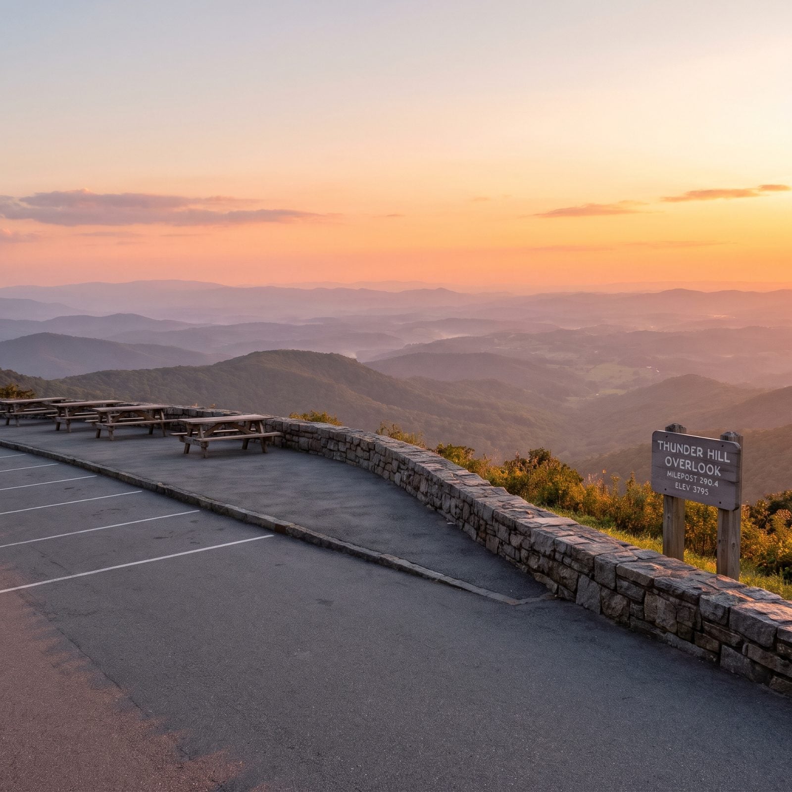
Just north of Blowing Rock at 3,795 feet, the land drops away east toward the Piedmont, and Thunder Hill has quietly built a reputation as one of the Parkway’s sunset spots.
Two things make it practical. There’s plenty of parking, which matters when you’re hauling length, and there are picnic tables, so you can eat while the sky goes orange. Cross the Parkway to the nearby hilltop for an even wider sweep. Blowing Rock’s own tourism folks list it among their local picnic spots, which tells you the regulars rate it.
9. Graveyard Fields Overlook (Milepost 418.8)
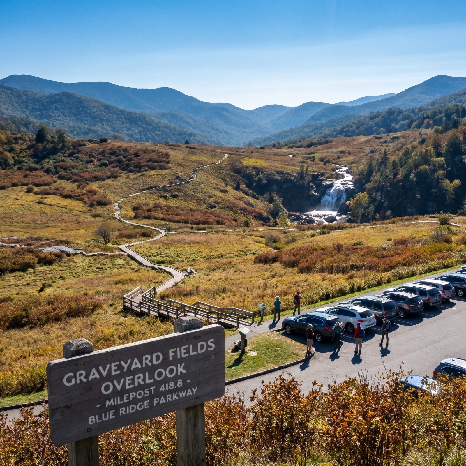
The trailhead for a 3.2-mile loop that runs over boardwalks and through high open meadows to two waterfalls, managed by Pisgah National Forest. One of the few Parkway hikes with an actual bathroom at the trailhead, which the dayhike crowd never fails to appreciate.
Here’s the catch for big rigs. NPS flat-out says finding parking on weekends or in peak season takes an early start, and that lot fills with cars long before a motorhome has room to maneuver.
8. Fox Hunter’s Paradise Overlook (MP 218.6, Alleghany County)
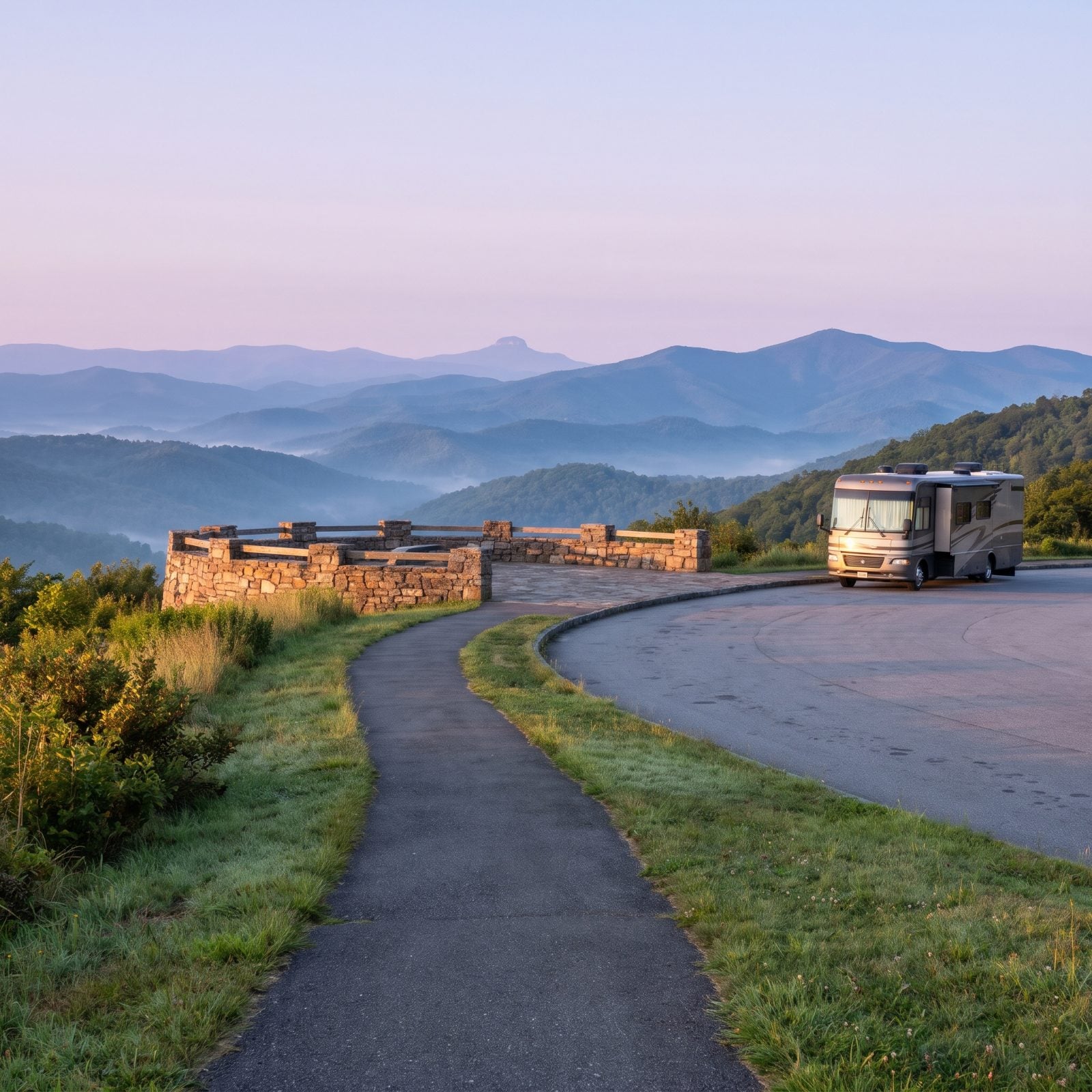
Come here before the coffee. The NPS flags this as a sunrise overlook for good reason, since the view faces east over Fisher Peak and stretches all the way to Pilot Mountain’s distinctive knob. On foggy mornings the Sauratowns poke up through the cloud like islands. You don’t forget that.
Big rigs welcome, too. NPS lists bus and RV parking at the pull-off, and a 0.2-mile accessible walkway leads to the stone deck without a single step. Tucked at MP 218.6 near the Virginia line, it’s one of the easier stops to roll into with length behind you.
7. Price Lake Overlook (MP 296.7, Julian Price Park)
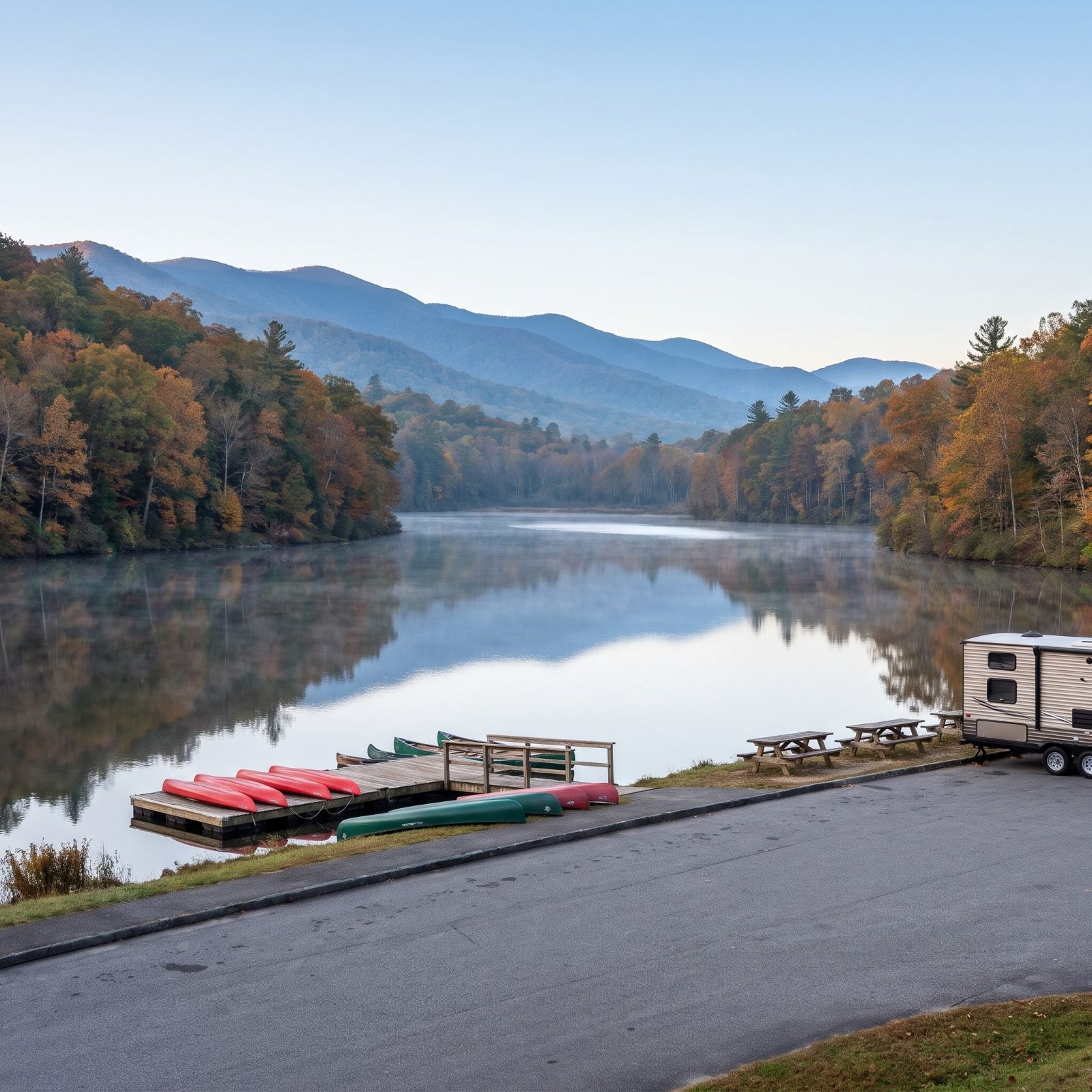
A rare overlook you can actually camp next to. Julian Price Campground reopened in October 2026, which turns Price Lake at MP 296.7 from a quick photo stop into a basecamp. Rent a kayak, canoe, or SUP from Price Lake Boat Rentals at MP 297 and spend the afternoon out on glassy water with the ridges mirrored back at you.
No swimming, so don’t plan a dip. Go do the easy 2.7-mile loop around the shore instead, dead flat and quiet in the early morning when the lake looks like poured glass.
6. Beacon Heights Overlook (MP 305.2, Grandfather Mountain’s Flank)
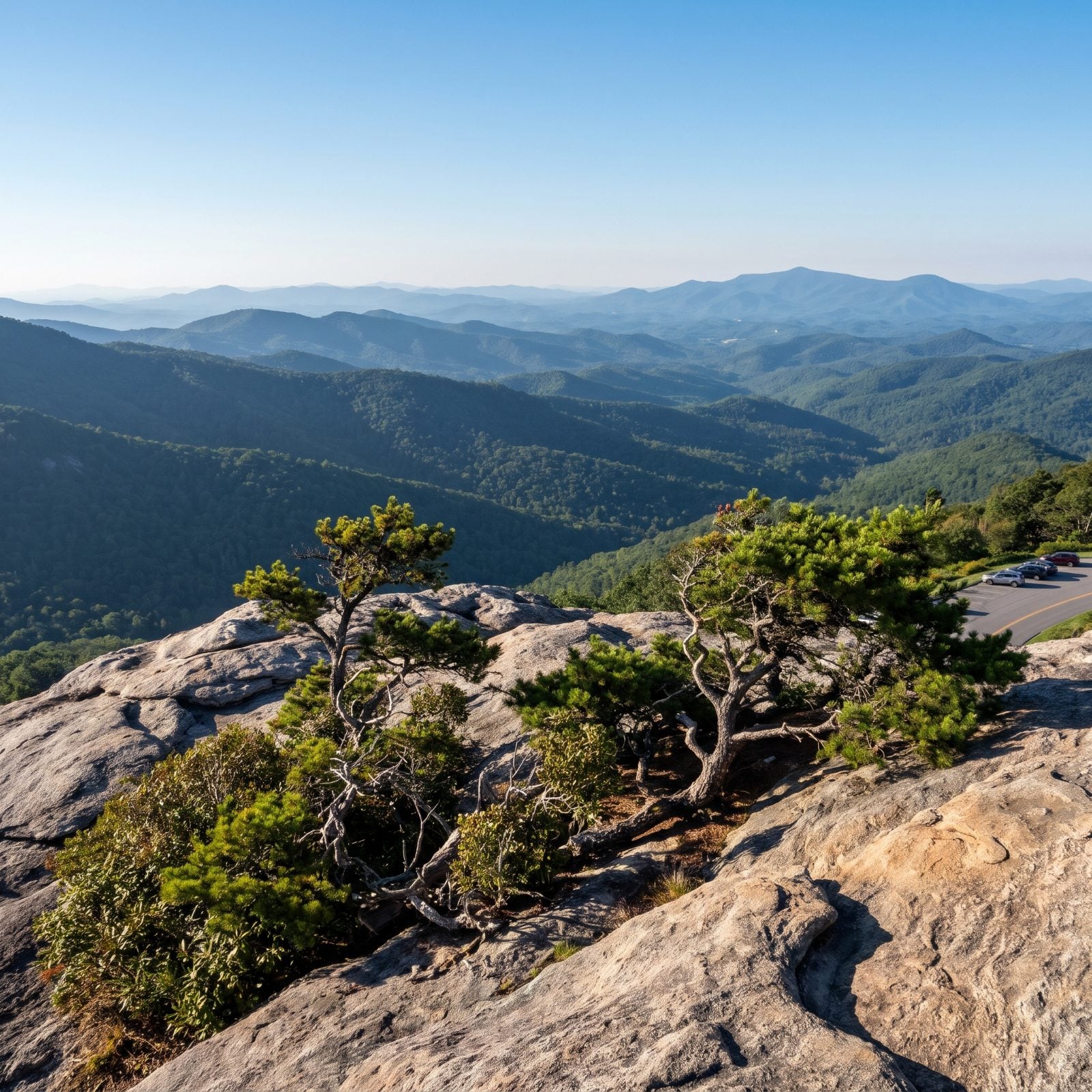
A short walk with an outsized payoff. That 0.3-mile trail from the MP 305.2 lot (about 0.7 round trip) climbs to open rock domes looking straight down on Pisgah National Forest. Almost no effort, huge sky. My favorite kind of math.
It sits right at the US 221 junction on Grandfather Mountain’s flank, and it doubles as the southern end of a one-way Tanawha Trail shuttle hike, roughly 4 miles down from Rough Ridge. Leave a vehicle here, start up north, and let gravity do most of the work.
5. Mount Jefferson Overlook (Between MP 266 and 267, Ashe County)
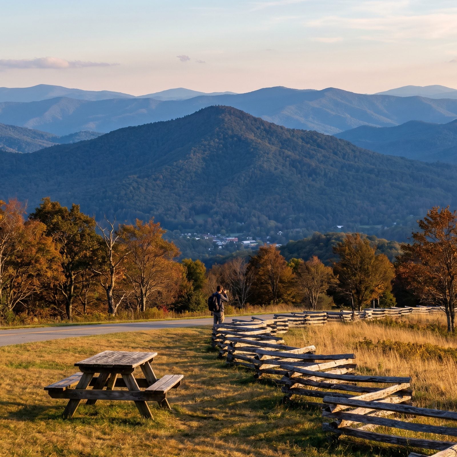
This one’s as much a doorway as a view. The Parkway borders Ashe County for 20 miles (MP 255 to 275), and Mount Jefferson Overlook sits right in the middle, facing the peak at whose foot the county seat of Jefferson sits.
Make it a side trip. Drop off the Parkway into West Jefferson for the downtown murals and the Ben Long frescoes, worth the detour on their own. One routing warning: NPS notes sporadic single-lane closures between MP 261.2 and 274.3, so check the daily road status before you commit a long rig to the drive.
4. Big Witch Overlook (MP 461.9, Near Cherokee), Mind the Tunnel
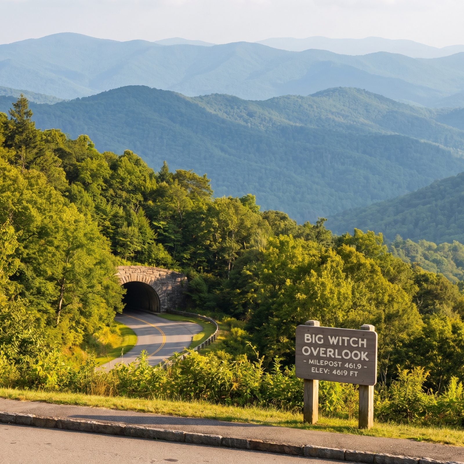
Gorgeous view, serious homework. Big Witch Overlook at MP 461.9 takes its name from a Cherokee medicine man, the “eagle killer” who gathered sacred feathers for ceremonies and died in 1898 at age 90. The history alone earns the stop.
But this is the Parkway’s tunnel gauntlet. Big Witch Tunnel at MP 461.2 gives you just 11 feet 7 inches at the edge line, the lowest clearance on the entire road. Lickstone Ridge and Bunches Bald nearby aren’t much taller. Tall rigs, do not try to sneak through.
Twenty-five of the Parkway’s twenty-six tunnels are in North Carolina. Know your rig’s height before you commit to a single mile of this road.
Safer play for a big motorhome? Come up from US 441 at Cherokee, which routes you through the taller Sherrill Cove (13 ft 11 in) and Rattlesnake Mountain (14 ft 8 in) tunnels instead.
3. The Doughton Park Overlooks (MP 241 to 244.7)
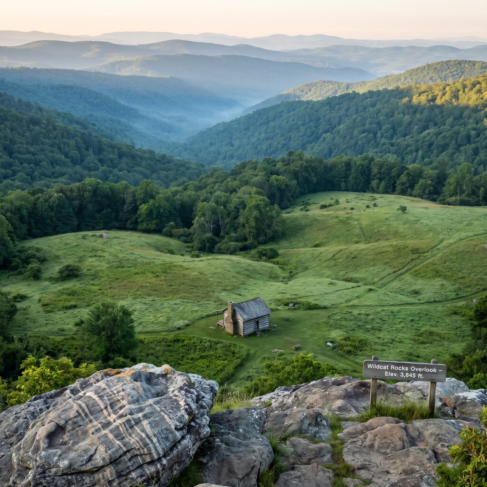
Not one overlook but a cluster worth slowing down for. Stand on the left side of Wildcat Rocks Overlook at MP 241, look straight down into the clearing, and you’ll spot the historic Caudill Cabin tucked in Basin Cove below, a log homestead left over from the area’s farming past.
A few miles on, Basin Cove Overlook (MP 244.7) drops your eye into Basin Cove. Between them, Alligator Back Overlook (MP 242.4) rewards a short walk to an outcrop striped with pinstriped stone that really does look like reptile skin. Bluffs Lodge is shuttered. But NPS lists The Bluffs Restaurant at Doughton Park and the US 21 access section as open, so lunch is back on the table.
2. Lost Cove Cliffs Overlook (MP 310, Where the Lights Appear)
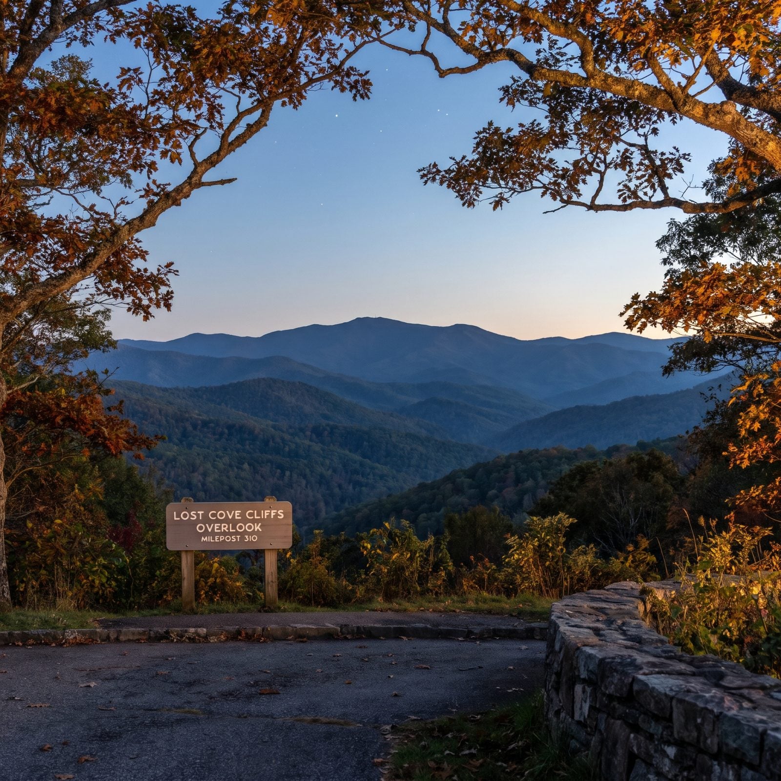
Stay for the dark. NCpedia calls Lost Cove Cliffs Overlook, near MP 310 about six miles north of Linville Falls, the best spot to catch the Brown Mountain Lights, those mysterious glows locals have argued about for generations.
Fair warning, the daytime view has gone soft. Vegetation has crept in and partly blocks the sightline toward Brown Mountain in Pisgah National Forest, so this isn’t a lunch-stop panorama anymore. Treat it as a fall evening stop, after dark, with patience and a thermos.
1. Pounding Mill Overlook (MP 413.2, Transylvania County)
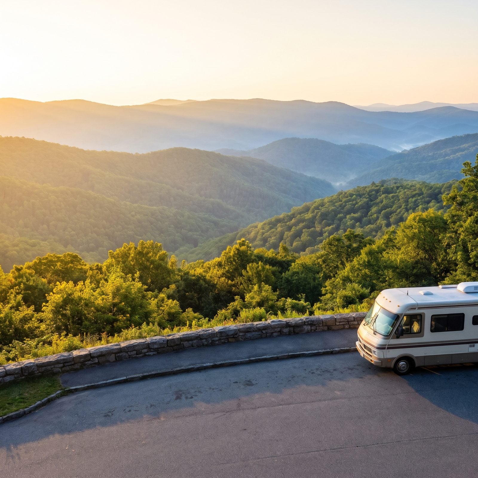
Explore Brevard ranks this among the best of Transylvania County’s dozen overlooks (MP 406.9 to 423.5), and it earns the spot. Pounding Mill at MP 413.2 opens onto ridge after ridge of Pisgah National Forest, framed by a curving stone wall and a paved pull-off roomy enough for an RV.
Routing works in your favor here. Come in from US 276 at MP 411.9 and head south, and there are no tunnels on the NPS list between you and the overlook. That access road loops back to Looking Glass Falls and Sliding Rock, so you can build a whole Pisgah afternoon around one stop.
Heads up if you keep rolling north. Mt. Pisgah’s 50-site picnic area (MP 407.8) and the seasonal Pisgah Inn sit a few miles up, but getting there means threading Frying Pan Tunnel at 13 feet 6 inches edge-line clearance.