
Every national park brochure lies by leaving things out. It shows you the one overlook, the one color, the one perfect hour of light, and then you drive six hundred miles expecting that exact frame. Nobody puts the geyser basin that smells like battery acid on the cover. Or the desert cactus buried in snow. Or the redwood coast that turns into a cold gray beach with nobody on it. These are the parks on their off days and odd corners, the versions you only find if you take the wrong turn on purpose. Most have real RV access. All of them are worth the detour.
Please note that some of the images in this article were created with the assistance of AI.
40. Yellowstone’s Steaming, Acid-Green Norris Geyser Basin
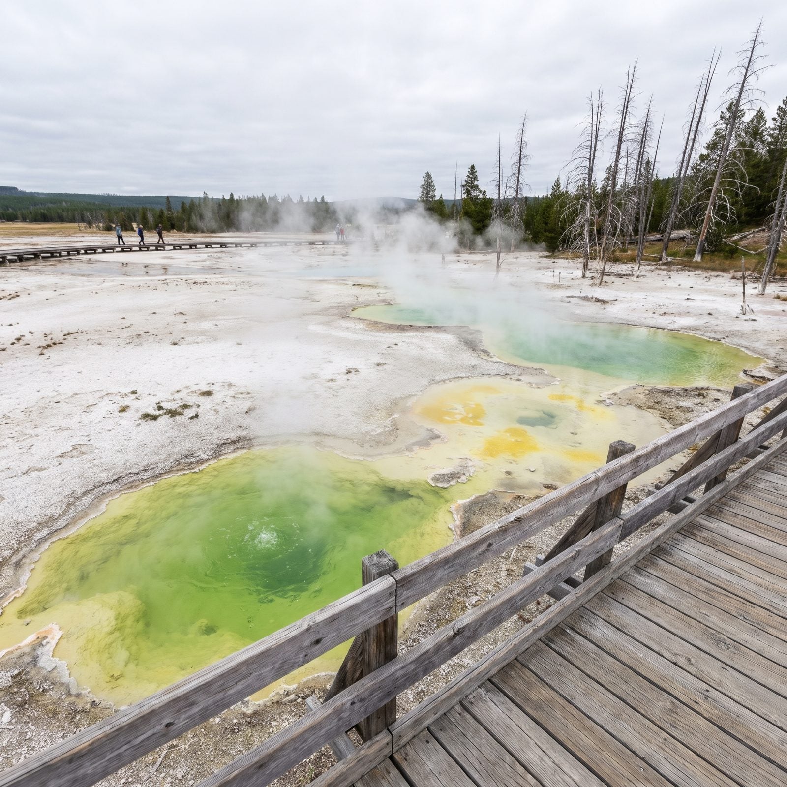
Forget the rainbow calm of Grand Prismatic. Norris is the park’s unstable, bad-tempered relative — the hottest and oldest thermal area in Yellowstone, and it changes month to month. Pools that were clear blue in June can turn milky, green, or disappear entirely.
The smell hits first. Sulfur, hot rock, something metallic. You taste it before you see much, and the whole Back Basin loop feels less like a scenic park than like standing on a thin crust over something that wants out.
The parking lot is small and fills by mid-morning in summer. Big rigs should drop the trailer at Canyon or Madison and come in a towed vehicle.
Writing in a Yellowstone volcano observatory column, an emeritus geologist notes that “Norris is the most dynamic geyser basin in the Park and its more than 500 hydrothermal features are the most diverse.”
39. Yosemite’s Treeless, Moonlike High Sierra Above Tioga Pass
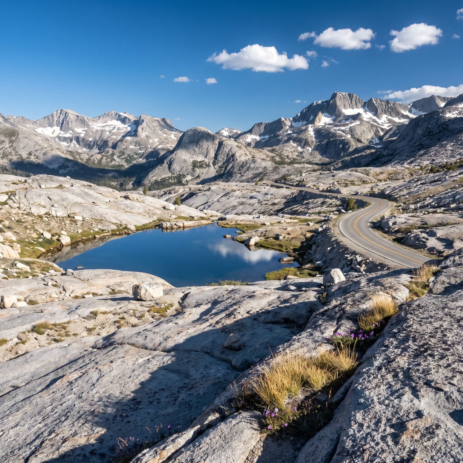
Everyone pictures Yosemite Valley. Granite walls, waterfalls, the meadow at golden hour. Drive up Tioga Road and the whole park swaps personalities on you.
Above 9,000 feet the forest thins out and quits. What’s left is a scraped-clean world of bald granite domes and shallow blue tarns — more moon than meadow, more rock than postcard. Tuolumne sits up here, wide open and quiet, and the air gets thin enough that a short walk feels like a long one.
The catch is timing. Tioga Road closes with the first real snow, usually late October, and doesn’t reopen until late May or June. We’ve planned a trip around it twice and had the gate shut on us once. Check the road status before you commit the whole route.
38. The Grand Canyon’s Snow-Buried North Rim Forests
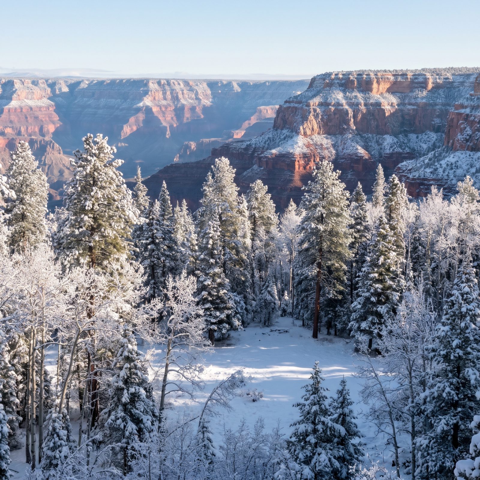
The South Rim is the one on every poster — open all year, mobbed. The North Rim is the one most people never see, and in winter they couldn’t if they tried.
It sits a thousand feet higher, cloaked in spruce, fir, and aspen instead of desert scrub. By December it’s buried under feet of snow, the lodge shuttered and the road closed. Nobody imagines the Grand Canyon as a snowy northern forest, but that’s exactly what the North Rim becomes.
If you want to RV it, the season runs mid-May to mid-October. The campground is small and books out months ahead.
37. Zion’s Wild, Empty Kolob Canyons
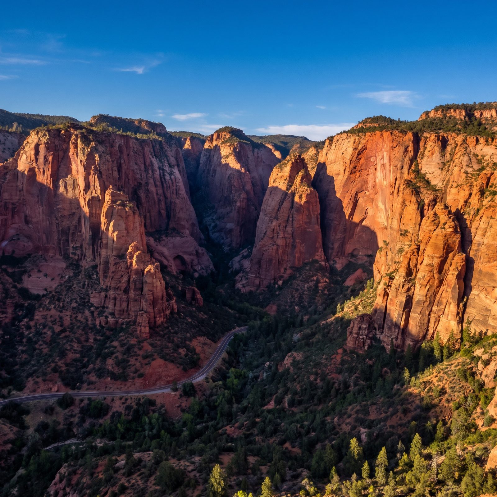
Mention Zion and people see the Narrows, the shuttle line, the sandstone cathedral packed shoulder to shoulder. Kolob Canyons is the part of Zion that forgot to get famous.
It has its own entrance off I-15, a good forty-minute drive from the main gate, and most Zion visitors never bother. What they miss is a set of deep red box canyons, finger canyons cut into a wall of crimson rock, usually quiet enough to hear your own footsteps.
The five-mile scenic drive handles RVs fine and dead-ends at a viewpoint. No shuttle, no reservation, no mob. This is the Zion people say doesn’t exist anymore. It does. It’s just up the highway.
36. Saguaro National Park’s Cacti Dusted in Fresh Snow
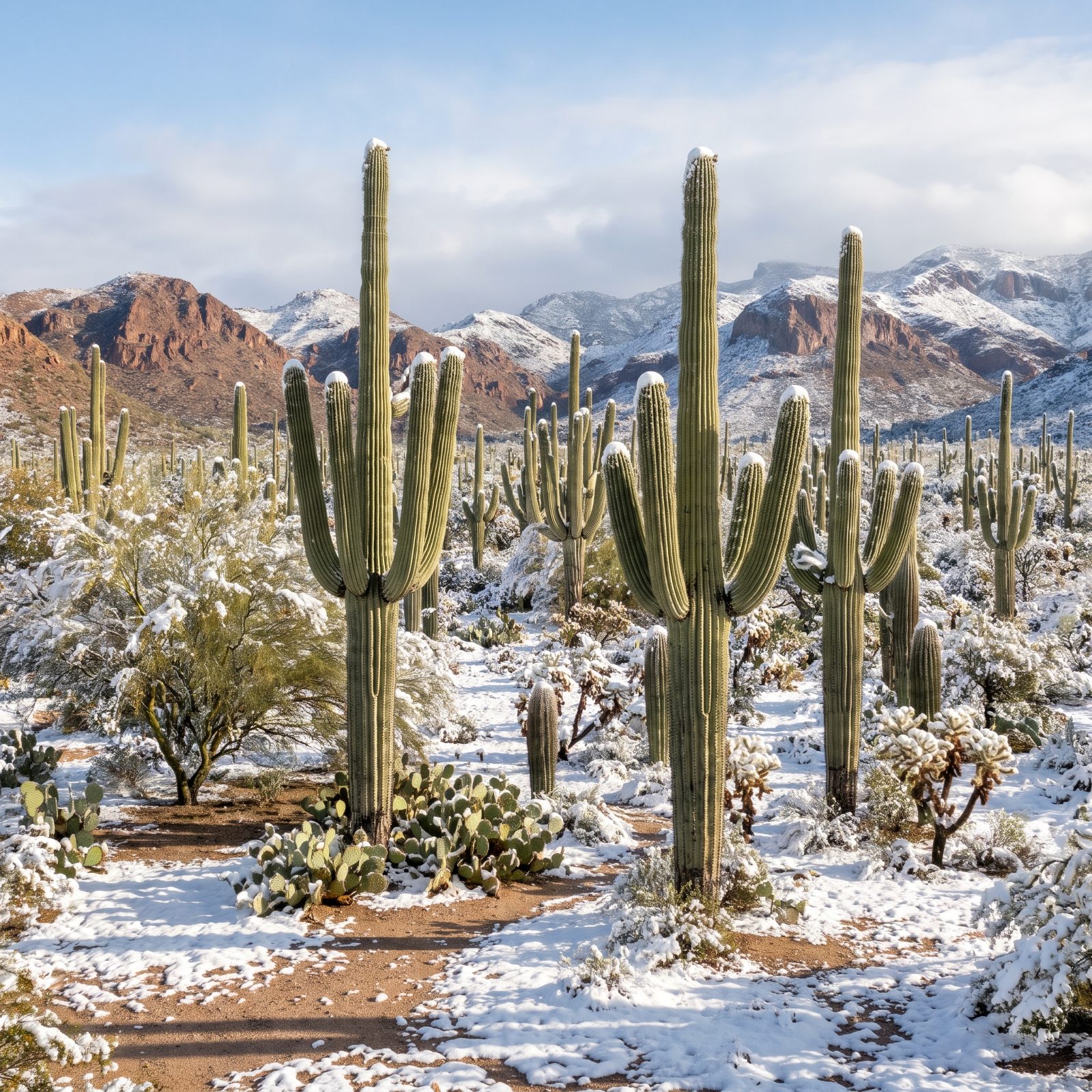
Snow on a saguaro looks like a photo someone faked. It’s real, and it happens a few times a decade around Tucson when a cold system drops low enough.
The giant cacti, some over 150 years old, stand there with white caps on their arms and powder settling in their pleats. The whole Sonoran Desert goes quiet and surreal — prickly pear and cholla outlined in snow, the Santa Catalina Mountains behind it all gone briefly alpine.
Both park districts are day-use, so overnight in Tucson. The scenic loop drives handle RVs, though some pullouts are tight.
35. Death Valley’s Hidden, Spring-Fed Darwin Falls
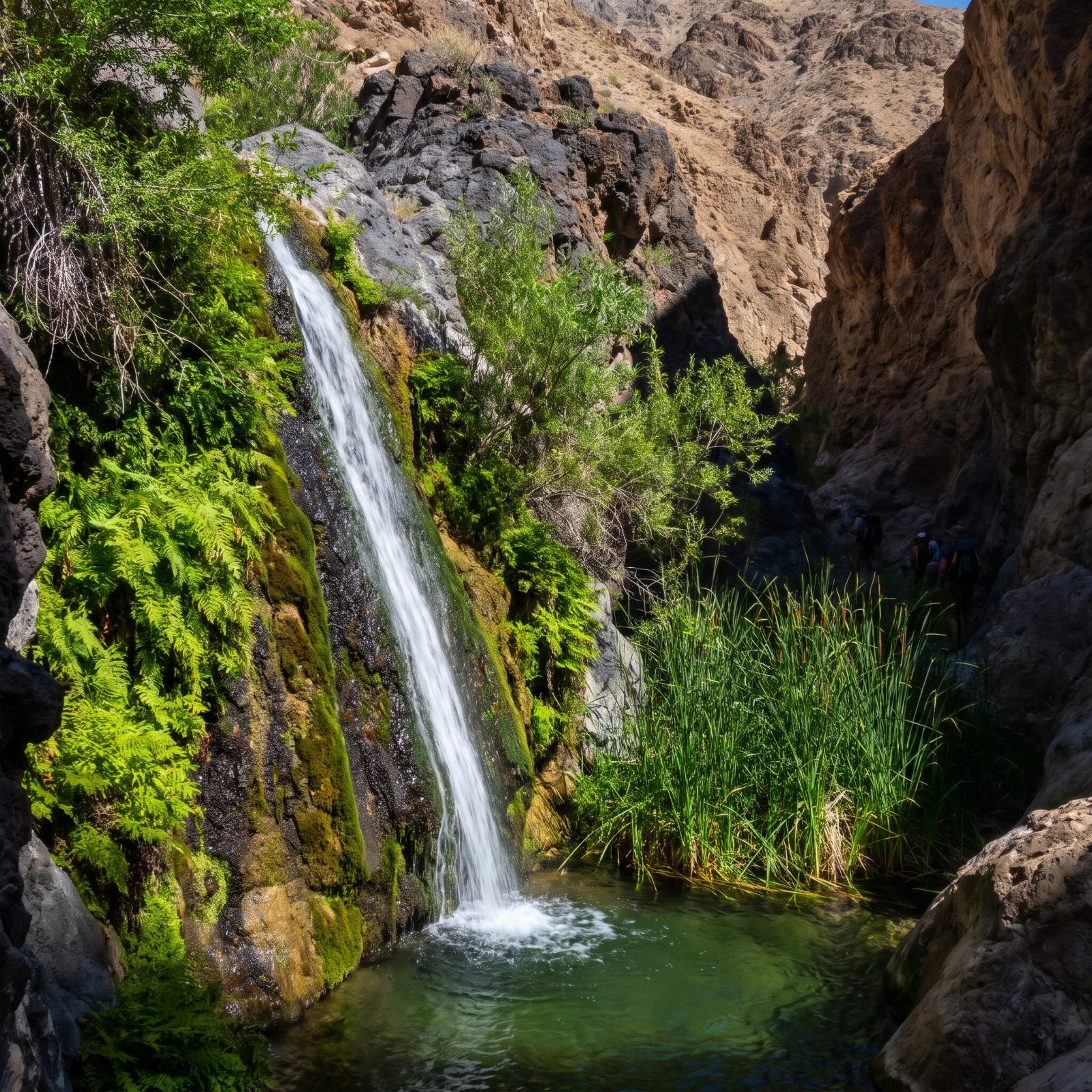
Death Valley is the hottest, driest place on the continent — and somewhere down a rough side road near Panamint Springs, it keeps a waterfall.
Darwin Falls runs year-round, fed by a spring that turns a slot of bare rock into a pocket of ferns, willows, and dripping moss. You hike about a mile up a sandy wash to get there, and the switch from oven-dry desert to cool green canyon happens in a few hundred feet. Last thing you’d expect the valley to be hiding.
The access road is unpaved and not RV-friendly. Park the rig at Panamint Springs, take a high-clearance vehicle to the trailhead, then walk in.
34. Haleakalā’s Bamboo Forest and Tropical Waterfalls
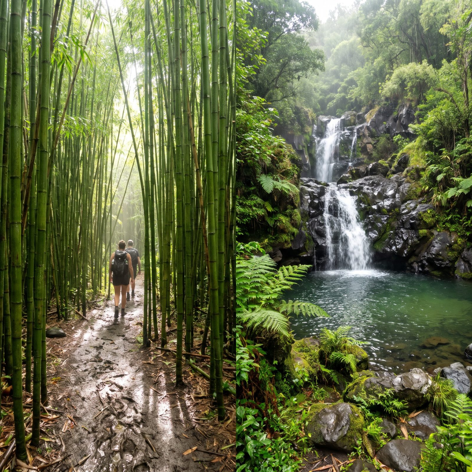
Say Haleakalā and the picture is the summit crater at sunrise: red cinder, bare volcanic moonscape, a sea of clouds below. That’s one half of the park.
The other half, the Kīpahulu district down on the coast, is a drenched tropical rainforest. The Pīpīwai Trail climbs through a tunnel of bamboo so thick it clacks in the wind, past Makahiku and Waimoku Falls, the second dropping 400 feet down a fern-covered wall. Same park as the barren summit, thirty miles and about 10,000 feet of difference.
The Hāna highway is narrow and twisting. Leave the RV and rent a small car for this stretch.
33. Bryce Canyon Under Deep Winter Snow
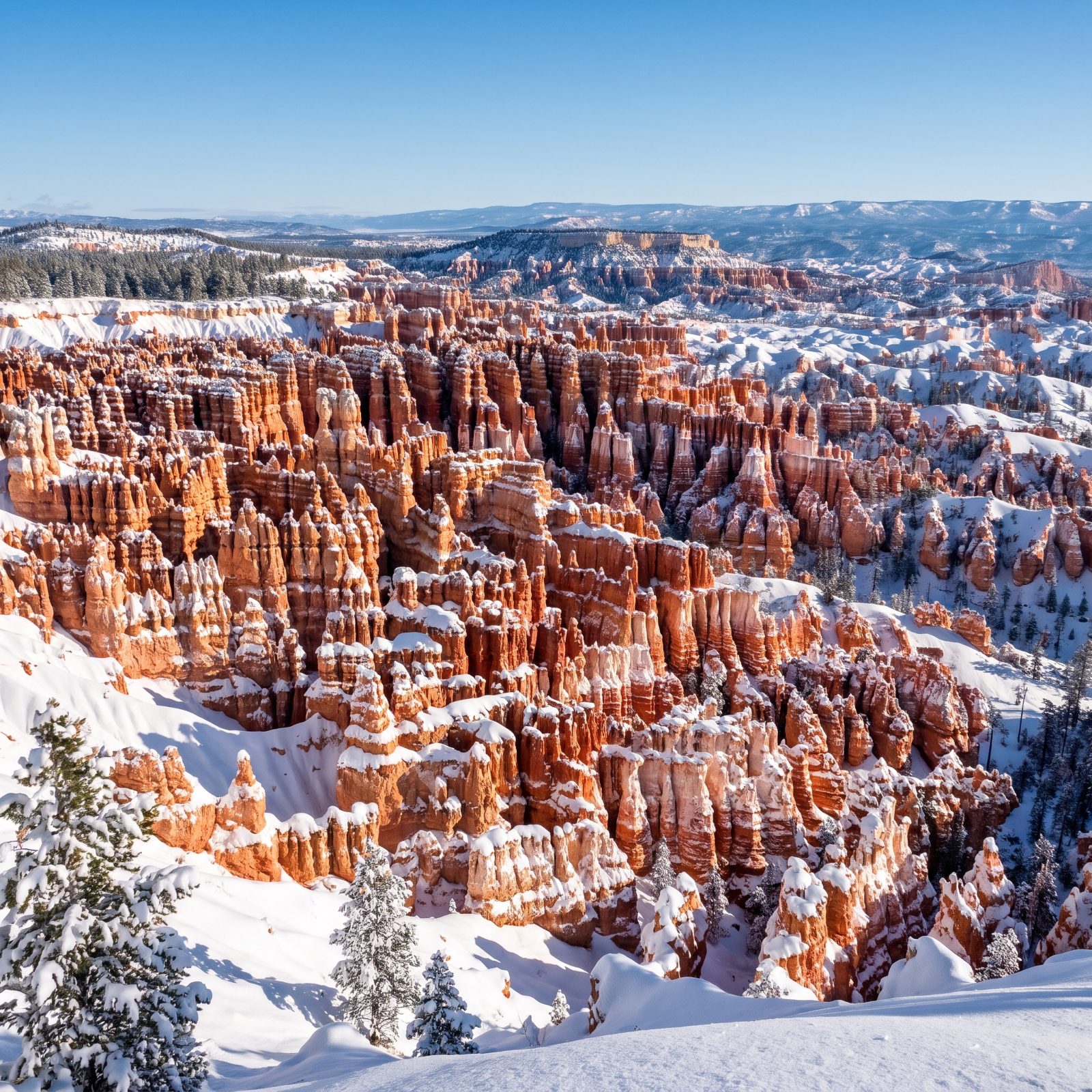
Bryce is a summer postcard: orange hoodoos against blue sky, baking in the Utah sun. In winter it becomes the best version of itself, and almost nobody’s there to see it.
The park sits above 8,000 feet, so it gets real snow — feet of it. The hoodoos keep their warm coral color while everything between them fills with white, and the whole amphitheater turns into something that shouldn’t be possible: a red-rock canyon in a snow globe.
The main road stays plowed in winter and the park rents snowshoes. The campgrounds mostly close, but Ruby’s Inn just outside has RV sites open year-round. Cold nights, so bring the good furnace. We underestimated Bryce in January once and regretted it by 2 a.m.
Making the case for a winter trip to Bryce, an outdoors columnist writes: “With snow, the hoodoos’ colors seem more vibrant and you can cross-country ski, snowshoe and take part in other winter activities. Winter lodging rates are more affordable and you won’t encounter crowds at the overlooks or on trails.”
32. The Everglades’ Dry, Fire-Shaped Pine Rocklands
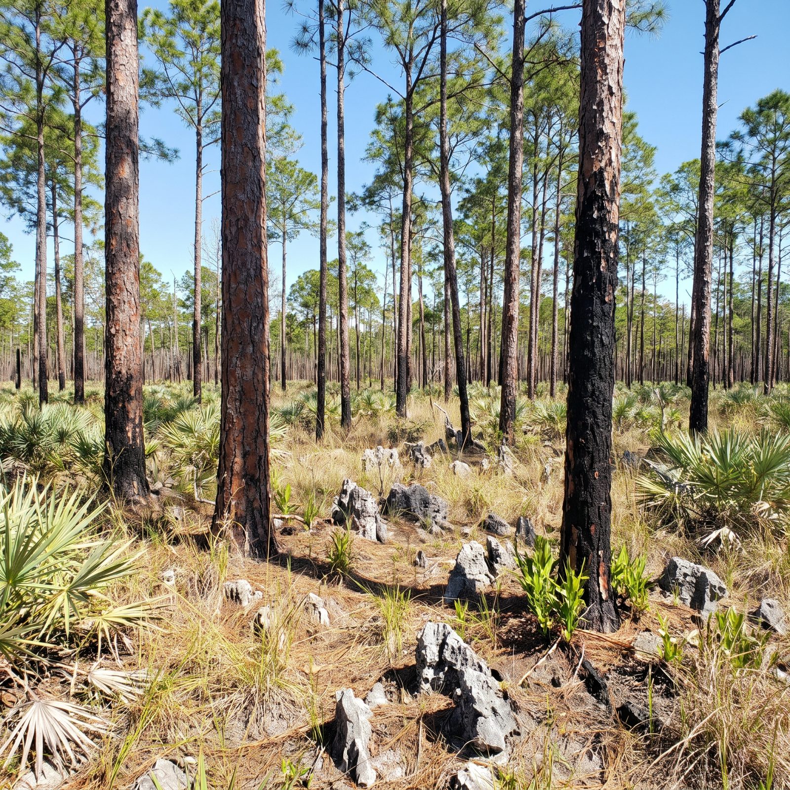
Mention the Everglades and you get sawgrass, airboats, alligators sliding into dark water. The Pinelands trail off the main park road tells a different story entirely.
This is pine rockland — a dry upland growing on exposed limestone, one of the rarest habitats in North America. Slash pines spaced wide apart, palmetto underneath, bare gray rock everywhere. It needs fire to survive, so the Park Service burns it on purpose. Walk it on a hot afternoon and the Everglades feels less like a swamp and more like a dry, open woodland.
The main park road from Homestead to Flamingo handles RVs the whole way, and the Pinelands pullout is an easy stop. Flat, quiet, and nothing like the brochure.
31. The Redwoods’ Wild, Fog-Wrapped Pacific Beaches
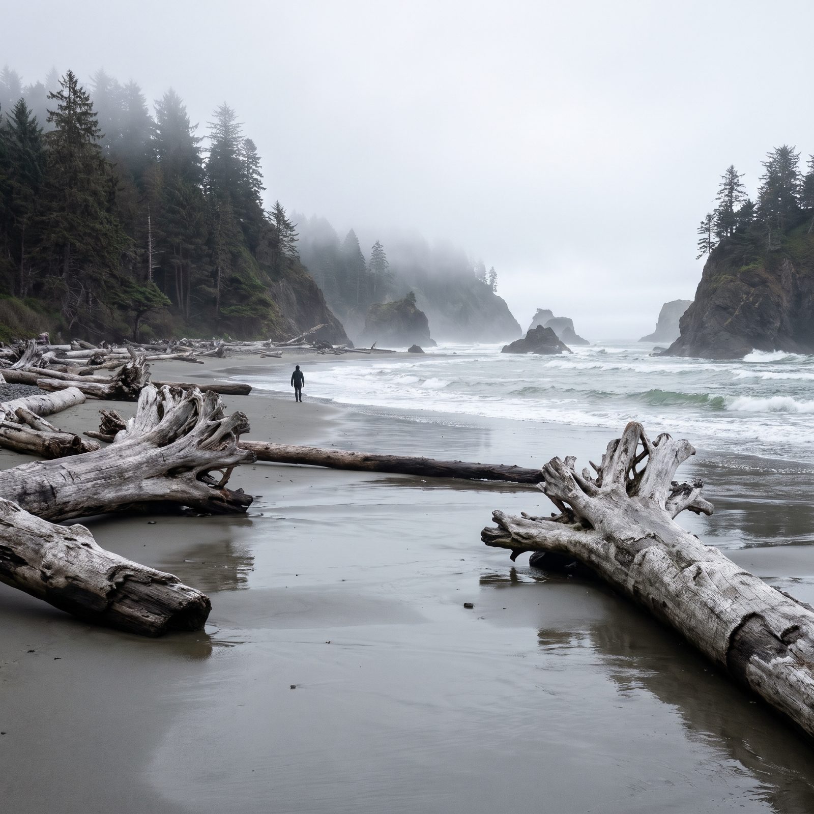
The redwood photo everyone knows is the same every time: a shaft of sun through impossibly tall trunks, a person looking up, dwarfed. True, and worth it. It’s also only half the park.
Redwood runs all the way to the ocean, and the coast here is wild and cold. Gullies to Enderts Beach, False Klamath Cove, the long gray strands below Crescent City — driftwood the size of boats, sea stacks fading into fog, surf that means business. The forest climbs right down to the bluffs, so you stand with ancient trees at your back and the Pacific in your face.
Highway 101 and the campgrounds handle RVs well. Pack layers. Summer on this coast runs cold and damp, and we’ve watched plenty of visitors show up in shorts and regret it fast.
30. The Shadowy Stone Maze of Arches: The Fiery Furnace
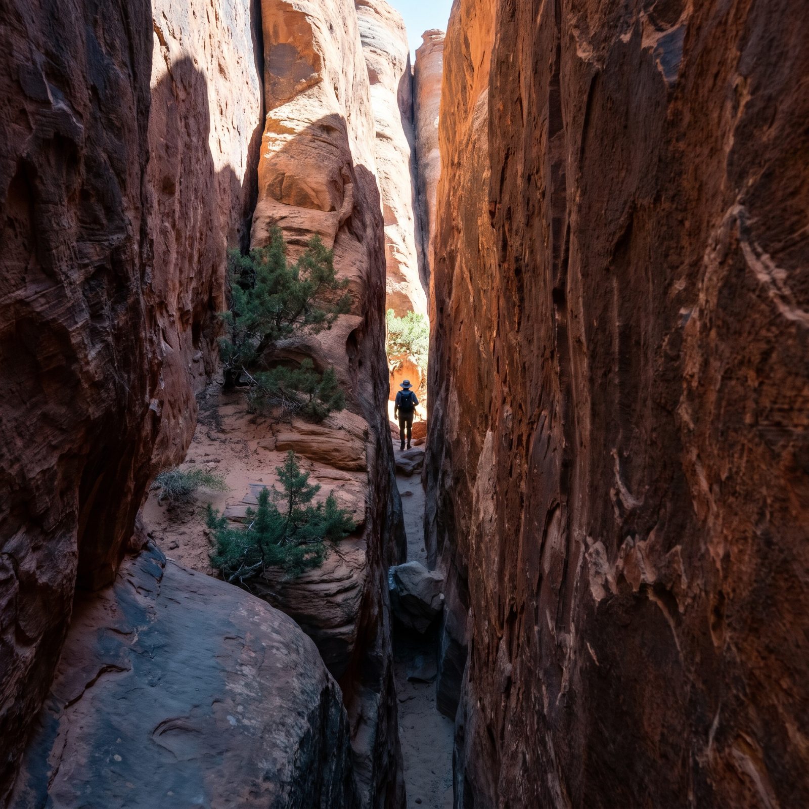
Everyone pictures Delicate Arch standing alone against a sunset. Almost nobody pictures the Fiery Furnace, and it sits right there off the main road.
It’s a tangle of sandstone fins that funnel you into shaded passages barely wider than your shoulders — cool, quiet, and dead easy to get turned around in. The park requires a permit here, either a ranger-led walk or a self-guided pass you reserve ahead, and spots go fast in spring and fall.
Park your rig at the main lot, where there’s plenty of big-rig room, then shuttle your attention here instead of fighting the arch crowds. The name fools people. It’s one of the coolest, dimmest corners in the whole park.
29. Glacier’s Grassy Front Porch: The Prairie Entrance at St. Mary
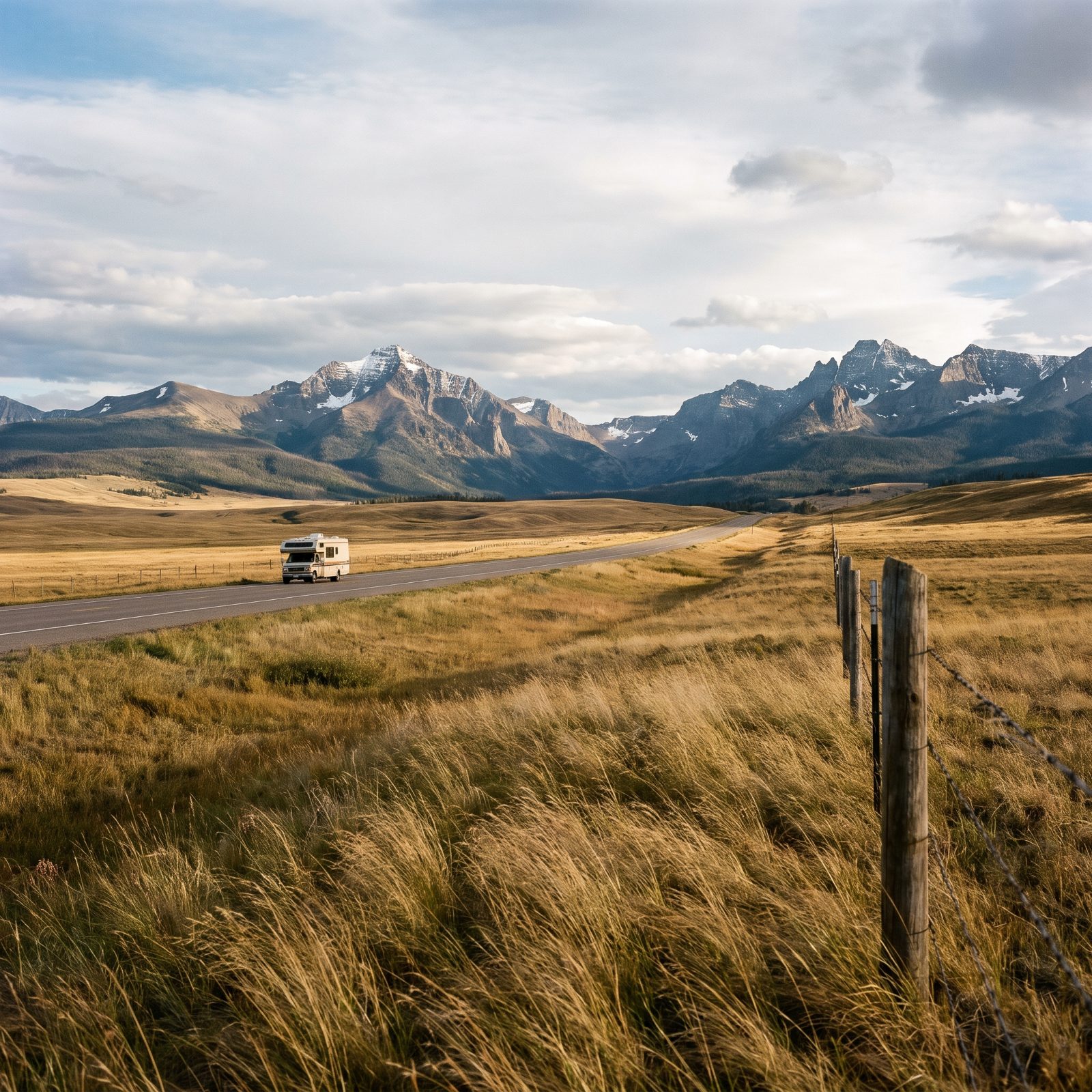
Say “Glacier” and people see Going-to-the-Sun Road hugging a cliff. The east side tells a different story. Drive in from Browning and you cross open prairie that runs flat for miles, and then the mountains slam straight up out of the grass with nothing in between.
This matters for a practical reason. The east entrances at St. Mary and Two Medicine see lighter traffic than the packed west side, and the approach roads are wide and easy on a big rig. The wind out here is real, though. It’ll push a tall trailer around like an empty cardboard box.
28. Mount Rainier’s Dripping Green Jungle: The Grove of the Patriarchs
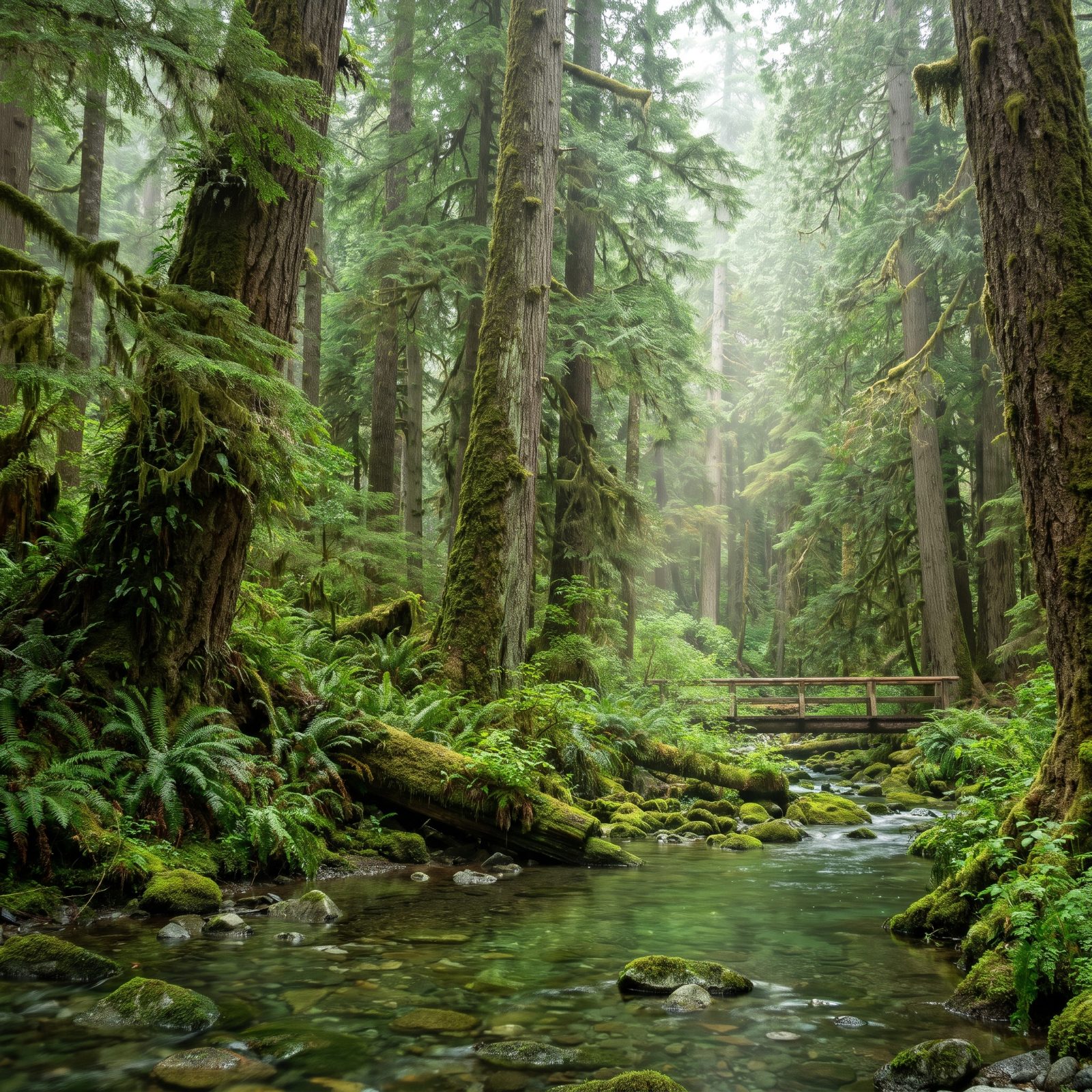
Snow cone of a volcano, right? That’s the postcard. But a chunk of Rainier is flat-out rainforest.
Down near the Ohanapecosh entrance the ground disappears under ferns, cedars go up fifty feet before the first branch, and everything drips. It smells like wet earth and bark. The Grove of the Patriarchs is the famous walk here — but check conditions before you plan around it, because the footbridge access has been on and off in recent seasons.
We always forget how much the lower park feels like the Pacific coast until we’re standing in it, soaked and grinning. The mountain’s still up there. You just can’t always see it through the trees.
27. Joshua Tree’s Secret Water: The Fan-Palm Oases
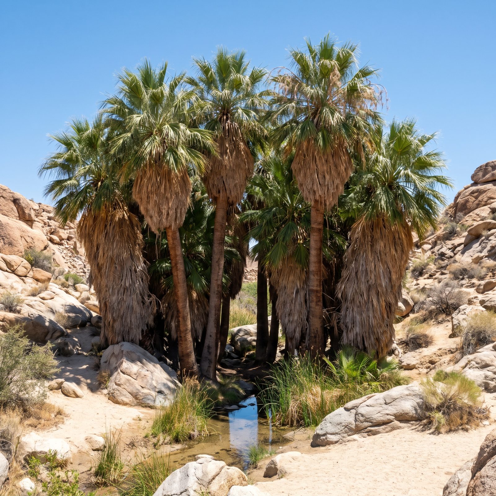
You’ve seen the spiky Joshua trees silhouetted against a pink sky. Here’s what the brochures skip: the park has real oases. Clusters of native fan palms, fed by groundwater, standing in the middle of all that dry rock.
The Cottonwood Spring and Lost Palms areas near the south entrance are the easiest to reach. Shaggy old palms, actual shade, and birds everywhere — because water in the desert pulls in everything alive.
26. Crater Lake’s Hoodoo City: The Pinnacles Valley
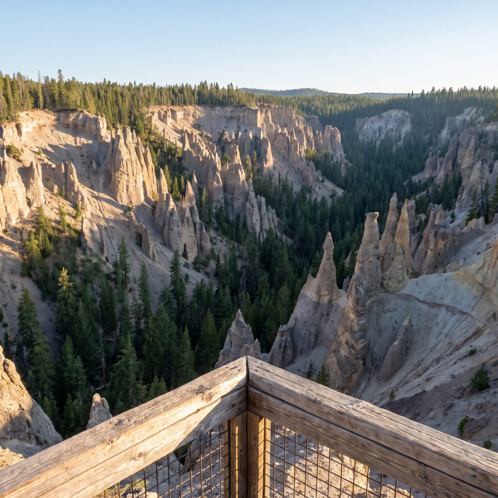
The blue. That’s all anyone remembers of Crater Lake, that impossible cobalt water. Fair enough. But drive the dead-end road to the Pinnacles overlook and you get something nobody mentions.
A whole canyon full of spires — hollow ash fumaroles eroded into needles that look like the chimneys of a drowned city. It’s at the far southeast corner, well past where most day-trippers turn around.
The road out is paved and manageable, though it’s a spur, so you’ll backtrack. Worth the extra half hour. You go for water and leave talking about rock.
25. The Smokies’ Treeless Summits: The Grassy Balds
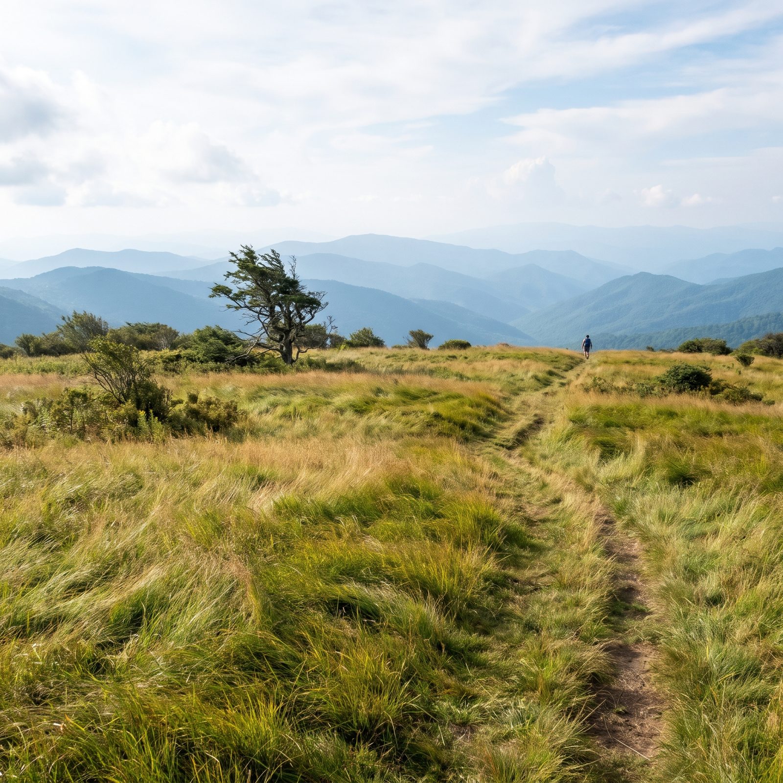
Misty blue ridges stacked to the horizon. That’s the Smokies everyone knows. What throws people is standing on a mountaintop with no trees at all.
The grassy balds — Andrews Bald and Gregory Bald among them — are open meadows sitting high on summits where you’d expect forest. Nobody fully agrees why they exist. Grazing history, old fires, soil quirks, the theories pile up.
They take a hike to reach, so you’ll leave the RV at a trailhead like Clingmans Dome. The payoff is a 360-degree view with grass under your boots instead of a dark spruce canopy over your head.
24. White Sands’ Disappearing Lakes: The Interdune Pools
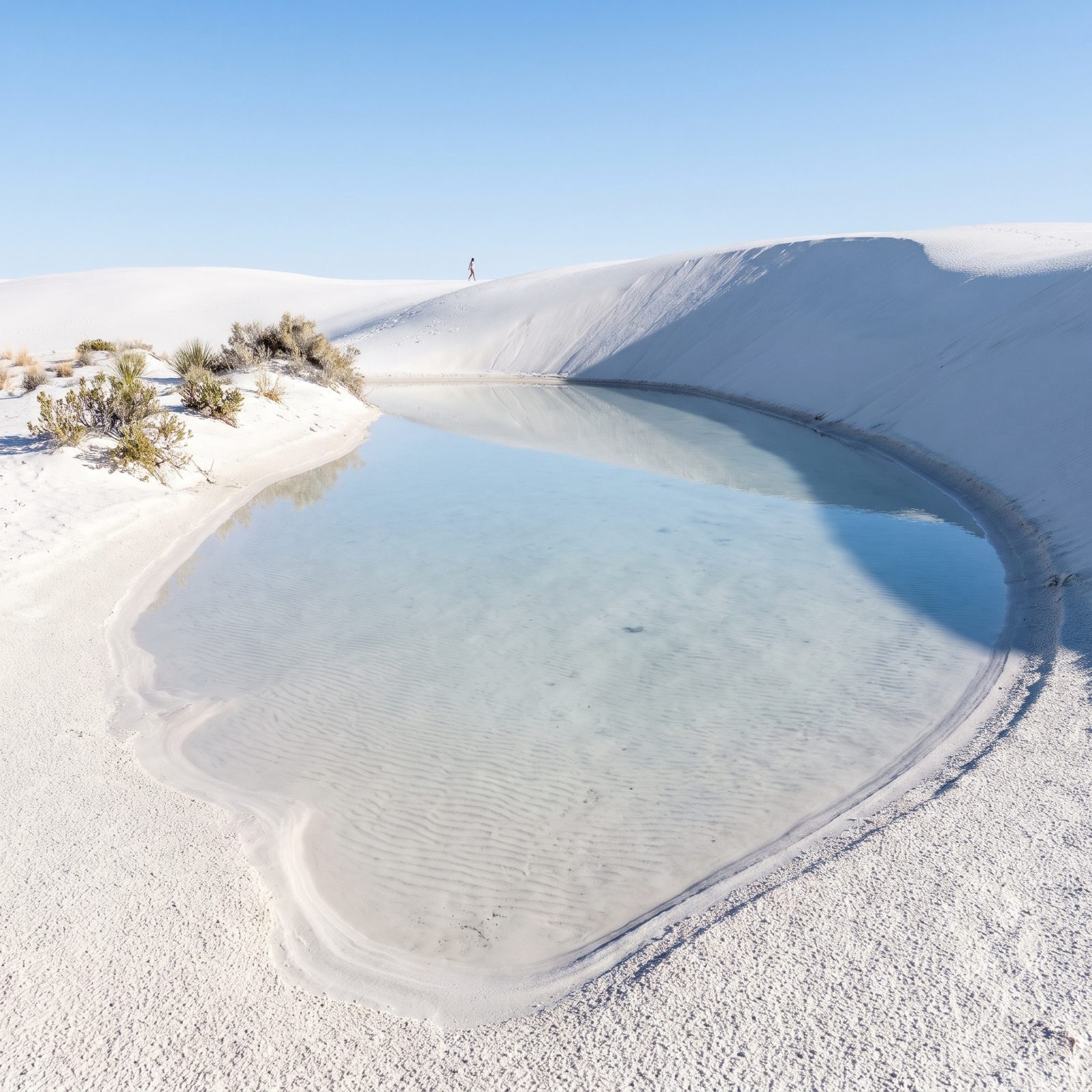
Endless white dunes, people sledding down them. You know the image. But after a hard rain, the low spots between dunes fill with water, and suddenly there are pools sitting in the middle of all that gypsum, mirroring the sky back at you.
They don’t last. A day or two of sun and they’re gone, so catching one is pure luck and timing. Go after a storm and watch the interdune hollows.
The park road is good for RVs, but there’s no water, no shade, and the glare is brutal. Midday here is like standing inside a lightbulb.
23. Capitol Reef’s Pioneer Orchards: The Fruita Historic District
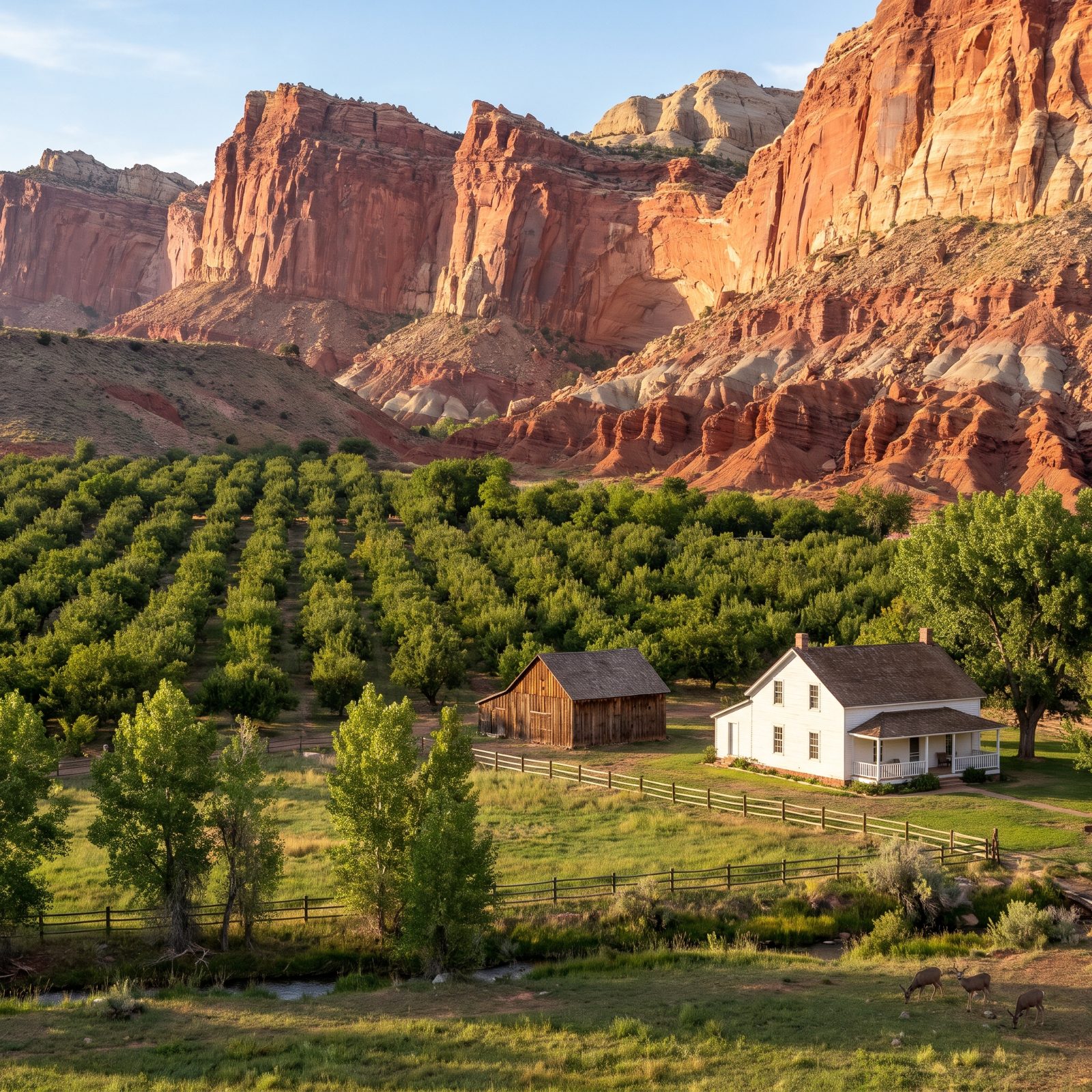
Red rock and slot canyons, sure. Then you round a bend and there’s a green orchard with apple trees and a white farmhouse tucked under thousand-foot cliffs. People do a double take every time.
Fruita was a Mormon settlement, and the park kept the orchards alive. In season you can pick fruit right off the trees, pay a small per-pound fee at a self-serve stand, and eat it in the shade.
There’s a developed campground right here — flush toilets, shaded sites, deer wandering through at dusk. It books up months out. Grab a reservation the day the window opens or plan on being disappointed.
22. Petrified Forest’s Painted Hills: The Blue Mesa Badlands
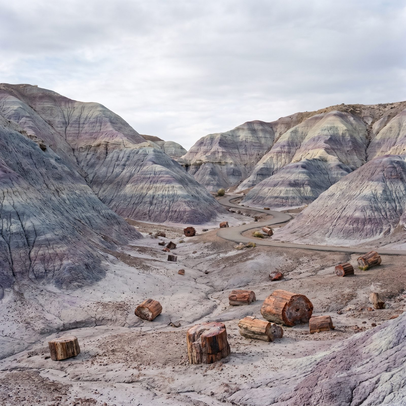
The name says forest, and you picture logs turned to stone, which you’ll find. The surprise is the ground they sit on.
At Blue Mesa the hills go blue and purple, banded bentonite clay in cool pastels that look painted on. It barely reads as Arizona. More like something off another planet’s travel ad.
The park has one paved road running its length, easy for any RV, with short loop trails off it. Blue Mesa is a quick walk down into the color. Pull off, stretch your legs, and stand in the one corner of this park nobody expects.
21. Carlsbad’s Desert Up Top: The Chihuahuan Surface
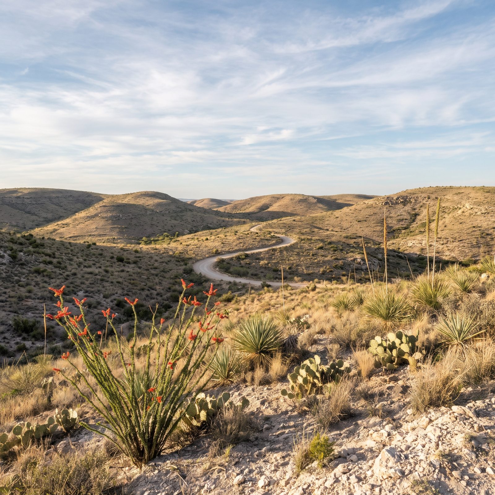
Everyone goes to Carlsbad for what’s underground. Fair. The cave is the reason the park exists. But the surface gets written off as a parking lot with an elevator, and that’s a shame.
Up top it’s living Chihuahuan Desert — agave and ocotillo and prickly pear scattered across rolling limestone hills. The scenic loop road out of the visitor center is a slow, easy drive that most cavern visitors skip entirely.
Do the cave in the cool of morning, then give the desert an hour. Same ticket, no crowd, and at dusk you can watch the bats pour out of the cave mouth. That part, people remember.
20. The Riverside Hot Spring at Big Bend That Beats Any Resort Soak
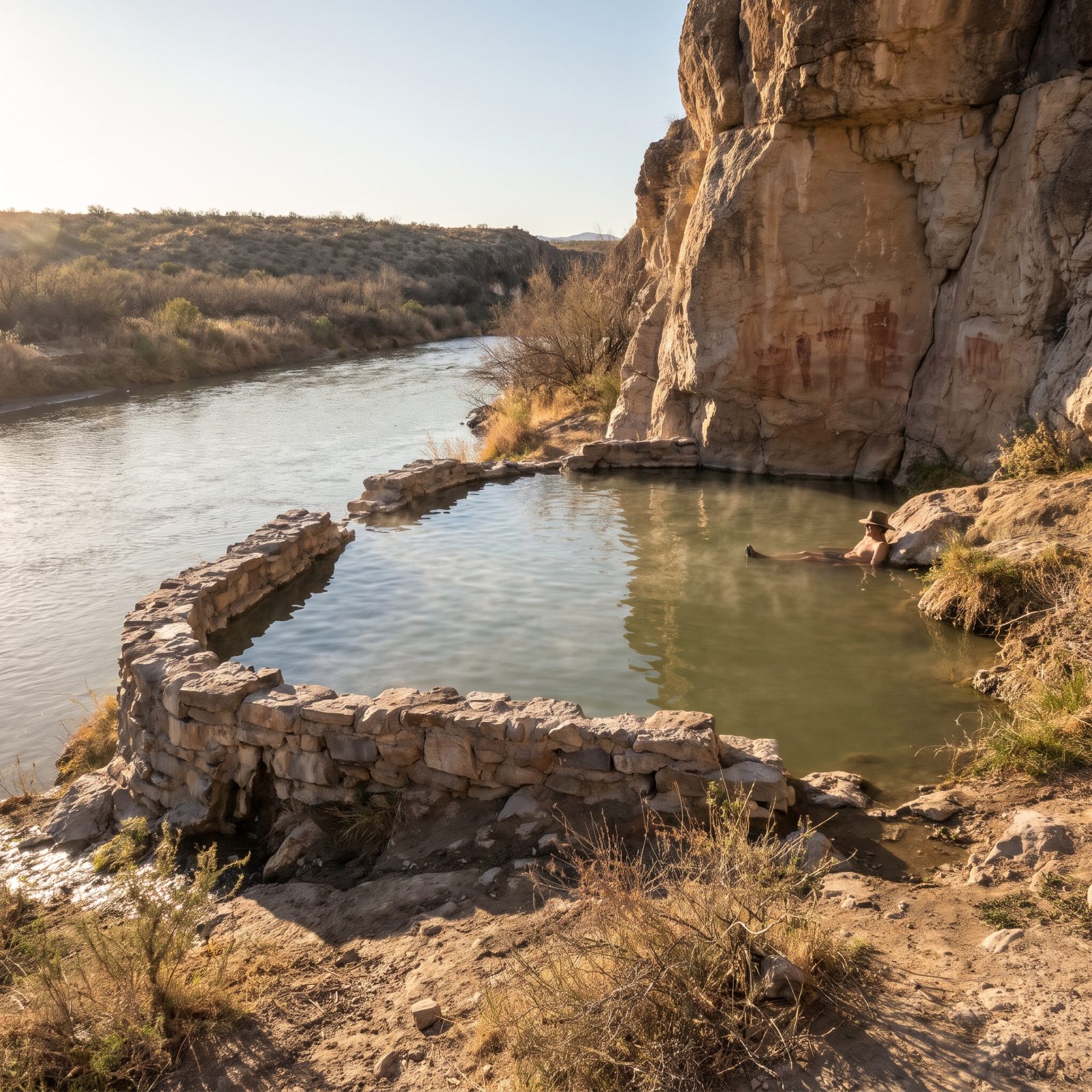
Everyone pictures Big Bend as the Chisos Mountains at sunset. Fewer know you can lower yourself into steaming mineral water with the Rio Grande sliding past your elbow, the whole pool held inside the stone foundations of a bathhouse built more than a century ago. River on one side, warm water on the other, maybe a foot of rock between them.
The catch? No big-rig access near the spring. That dirt road to the Hot Springs parking is narrow and tight on the turns, and the Park Service flat-out tells larger RVs and trailers to skip it. Park at Rio Grande Village and drive in with a car or truck.
19. Kobuk Valley’s Arctic Sand Dunes: The Sahara Above the Arctic Circle
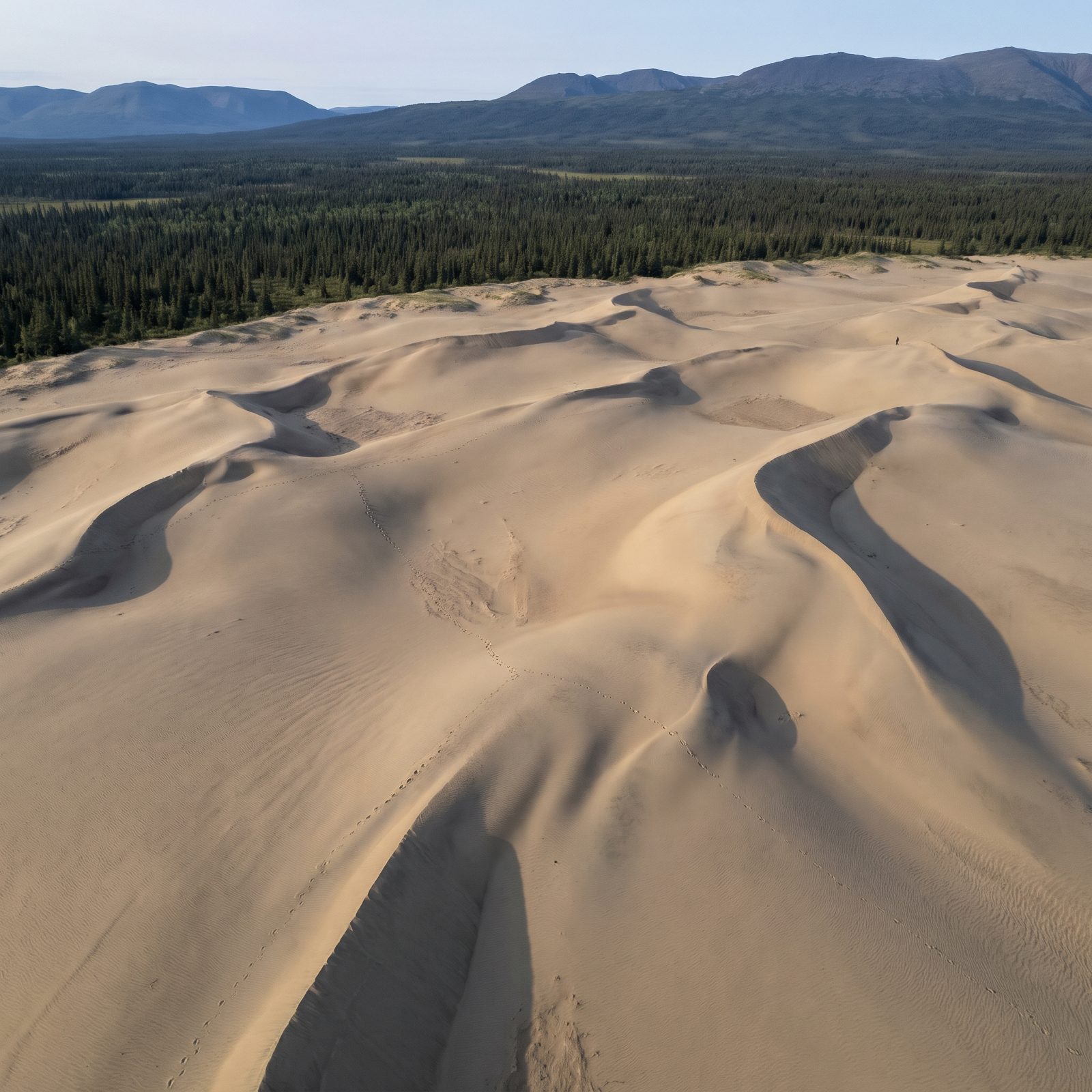
Real sand dunes, miles of them. Above the Arctic Circle. In a state most people file under glaciers and salmon.
Here’s the honest part: you cannot drive here. No roads lead into Kobuk Valley, none at all, and there’s no campground or visitor center inside the park. You fly in by bush plane from Kotzebue or Bettles, which parks this one firmly in the bucket-list column rather than the next-road-trip column for most of us.
We’re including it anyway because it messes with your whole idea of what an American national park can be. The dunes climb to around a hundred feet, summer days never fully go dark, and caribou herds cross the Kobuk River nearby. The postcard it challenges is Alaska itself.
After flying over the Great Kobuk Sand Dunes, a park ranger wrote: “I had heard the sand dunes described as a scene out of the Sahara, but I’ve seen the sand dunes of the Sahara and they are nothing like this.”
18. Congaree’s Flooded Old-Growth Forest Where the Trees Stand in Water
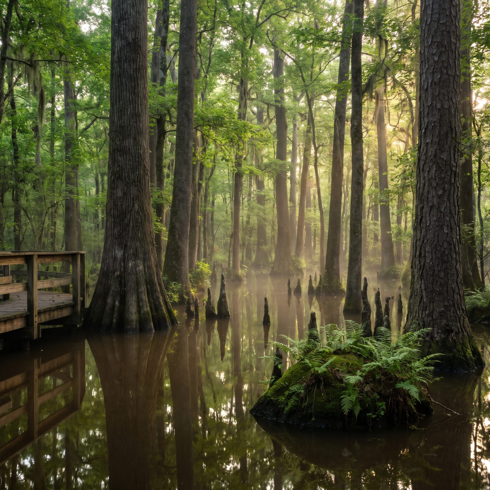
Say “national park” in the South and people picture the Smokies. Congaree is the opposite kind of place: flat, wet, and home to some of the tallest trees east of the Mississippi, with champion cypress and pine that push well past a hundred and fifty feet.
Nobody tells you this until you arrive. The water moves. Congaree isn’t a swamp, it’s a floodplain, and after heavy rain the whole bottomland fills and the boardwalk can close on you. Check conditions before you commit to the drive.
Good news for RVers: the park is an easy run from Columbia and entrance is free. No developed RV campground inside, though, so most folks stay nearby and come in for the day.
17. Voyageurs’ Frozen Winter Ice Roads You Can Actually Drive
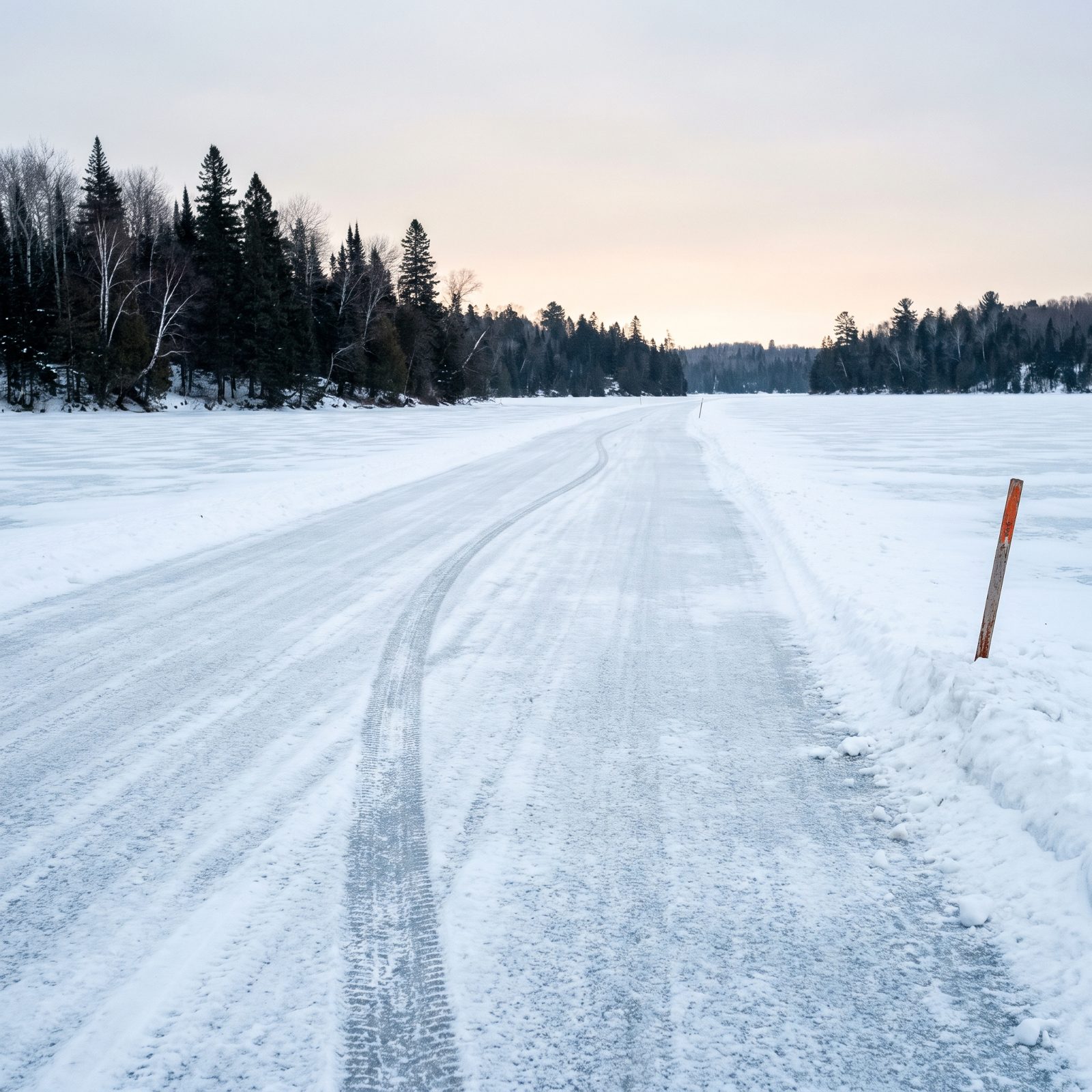
Most of the year, Voyageurs is a water park, and you need a boat to reach much of it. Then winter arrives and the Park Service plows roads straight out onto the frozen lakes.
You read that right. From roughly January into March, depending on how thick the ice has gotten, the Rainy Lake and Kabetogama ice roads open to regular vehicles. One stretch is wide enough for passenger cars and small trucks. There are very few places in the national park system where the government maintains a road made of ice, and this is one.
Don’t bring the motorhome out onto it. Weight limits are posted and they’re strict, so ice travel is a car-and-light-truck affair. Park the rig and drive a section of frozen lake, though, and you’ll be telling that story for years.
In a behind-the-scenes explainer on how the park builds its ice roads, a conservancy writer cautions: “We can never predict the exact dates that the ice roads may be open, but historically they open near the beginning of January, and are closed near the middle of March.”
16. American Samoa’s Rainforest Canopy and the Flying Foxes Overhead
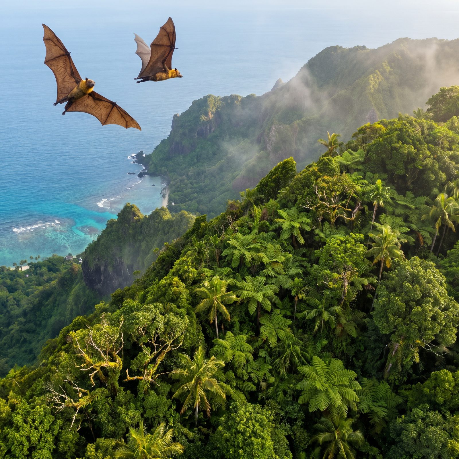
The only U.S. national park south of the equator, and almost nobody goes. It spreads across three volcanic islands, with reef, rainforest, and ridge stacked within walking distance of each other.
What throws first-timers is the sky. These islands are home to big fruit bats called flying foxes, with wingspans nudging three feet, and they feed in broad daylight. You’ll look up, track what you’re sure is a bird, and then realize it’s something else entirely.
No RVs here, obviously. You fly to Pago Pago by way of Honolulu. We mention it because it blows apart the idea of a national park as a place you drive your rig to.
15. Wind Cave’s Rolling Bison Prairie That Hides the Cave Entirely
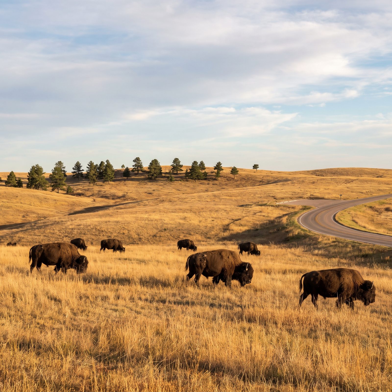
The name says cave. The surface says something else entirely.
Above one of the longest, most tangled cave systems on earth sits open mixed-grass prairie with free-roaming bison, pronghorn, and prairie dog towns. You could visit Wind Cave, never set foot underground, and still drive off convinced you’d seen a proper plains park.
For RVers this one’s a gift. The park sits in the southern Black Hills near Custer State Park, and Elk Mountain Campground inside Wind Cave runs first-come, first-served with no hookups. Sites handle mid-size rigs fine, but it’s dry camping, so fill your fresh tank before you roll in. Creep along the park road at dawn and the bison practically pose for you.
14. Katmai’s Valley of Ten Thousand Smokes: A Moonscape Where You Expected Bears
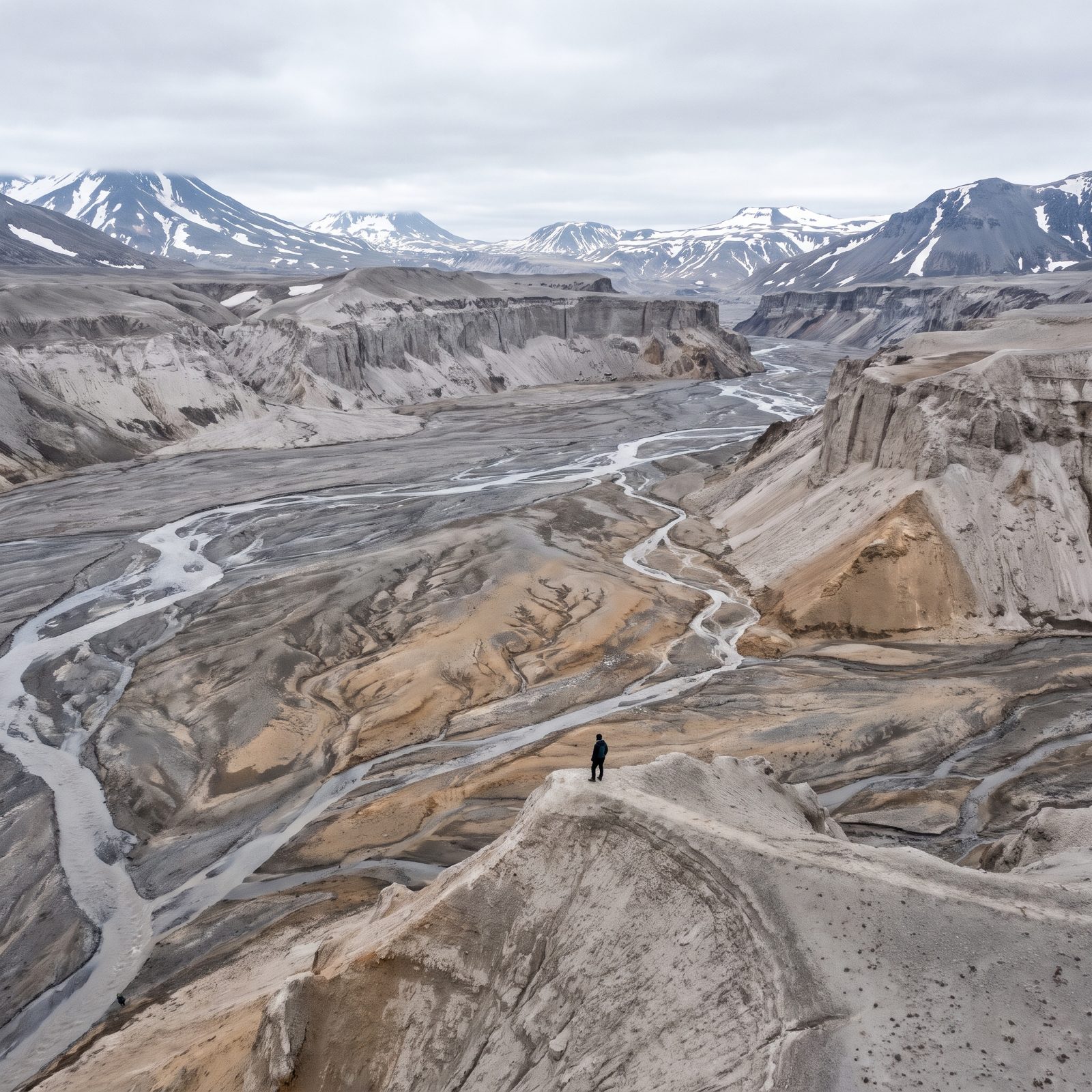
Katmai means one thing to most people: brown bears snatching salmon at Brooks Falls. That webcam fame is earned. But cross the park and you hit a valley that looks lifted straight off the moon.
In 1912 the Novarupta eruption, the largest anywhere on earth that century, buried this valley under hundreds of feet of ash. For years afterward, fumaroles smoked through the floor, which is where the name comes from. The smoke faded long ago. The ash moonscape never left.
You reach Katmai by floatplane, no roads in, and the valley sits a jarring bus ride from the lodge. It’s the single strangest terrain whiplash in the whole park system: salmon-rich green river to lifeless grey desert, same day.
13. Biscayne’s Mangrove Shorelines and the Shipwrecks Beneath the Blue
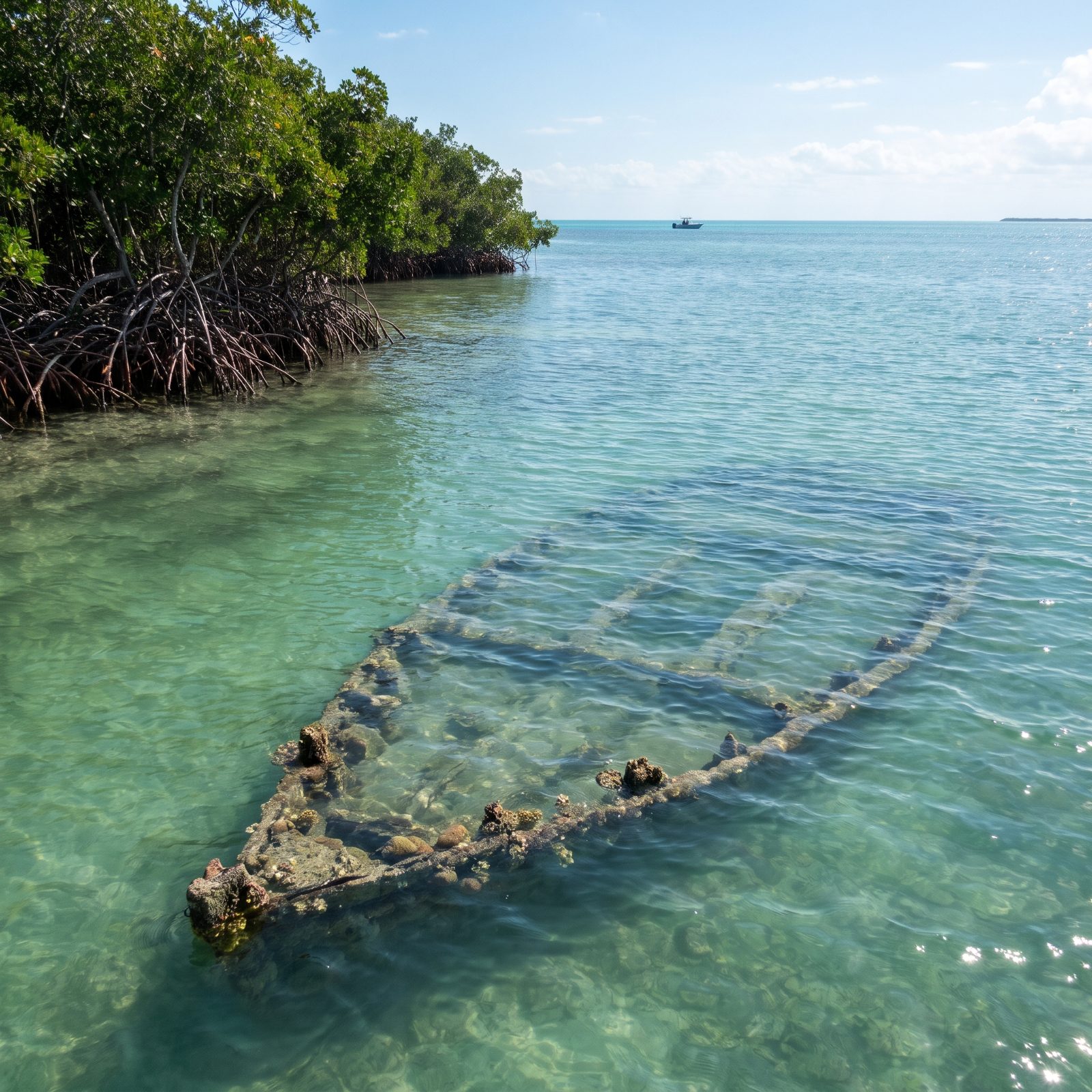
Almost all of Biscayne is underwater. That’s the twist. It sits right at Miami’s back door, yet nearly the entire park is reef, seagrass, and wreck hiding under a shimmering blue sheet.
The Maritime Heritage Trail is a snorkel-and-dive route linking old shipwrecks, a few of them more than a century down, resting in water shallow enough to visit with just a mask and fins. Up top, mangrove shorelines knit the keys together like green stitching.
Land your rig at the mainland visitor center in Homestead. From there it’s all boats and water. No in-park RV camping, and you’ll want a tour or your own vessel to reach the good stuff.
12. New River Gorge’s Abandoned Mining Towns Swallowed by the Woods
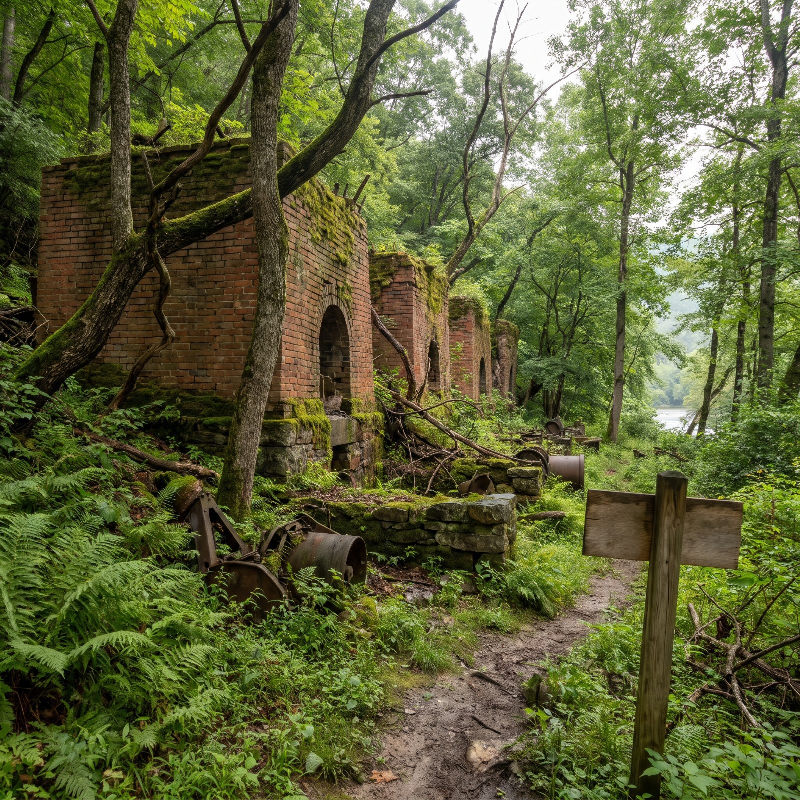
The famous shot is the New River Gorge Bridge arcing across the canyon. Walk into the woods below it, though, and you find something quieter and stranger: whole towns that coal built, then coal walked away from.
Thurmond, Nuttallburg, Kaymoor. Booming settlements once, now reduced to brick coke ovens, rusting conveyors, and foundations the forest is slowly dragging back under. You can walk right through them. It’s one of the eeriest corners of any national park, and it hides in plain sight below the overlooks.
Big plus for road-trippers. This ranks among the most RV-accessible of the newer national parks, close to I-64 and ringed by campgrounds. Developed camping inside the park is limited, so plan to stay nearby and day-trip the historic sites.
11. Lassen’s Painted Dunes, Where the Ground Burns Red and Orange
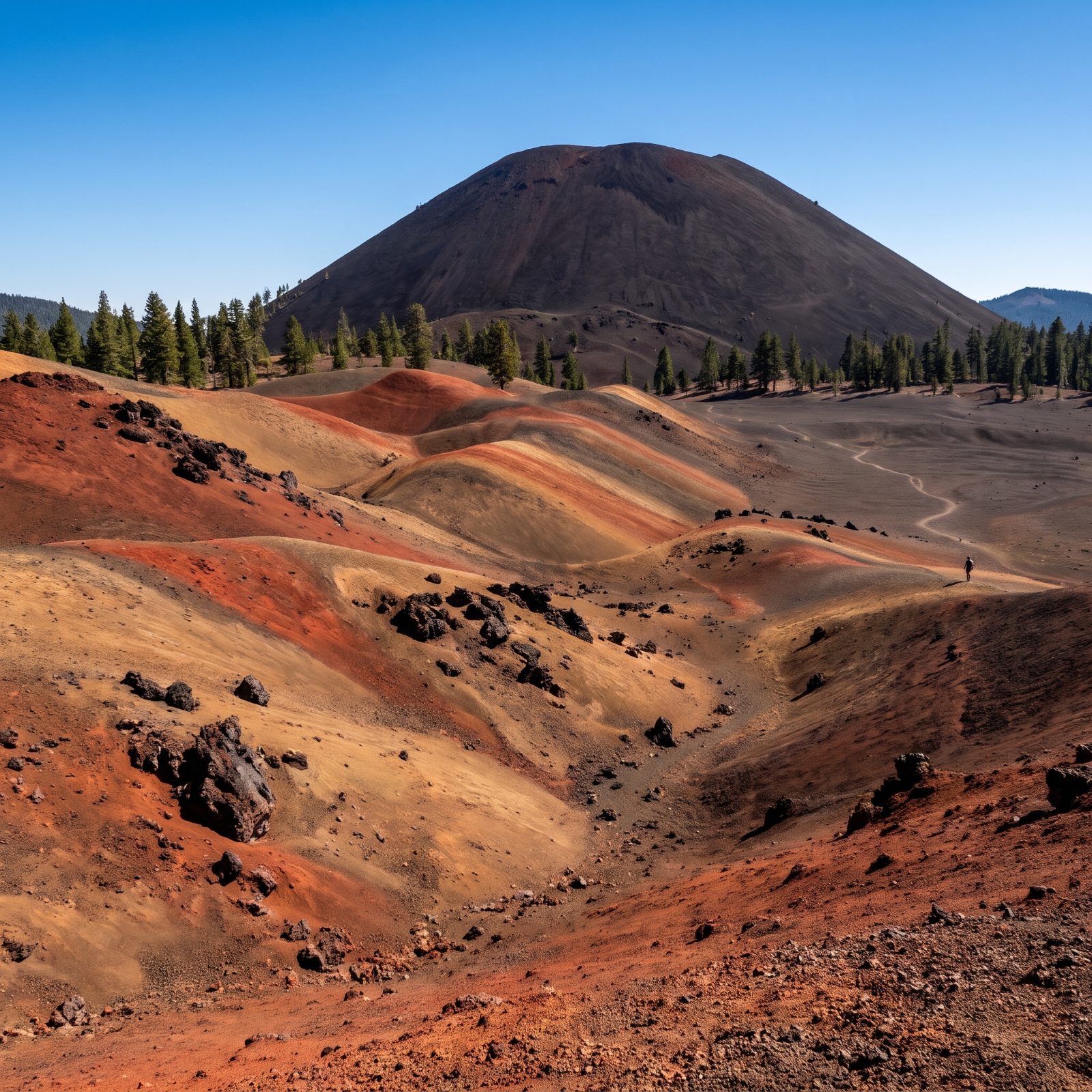
People drive to Lassen for the hydrothermal basins and the big peak. Then there’s the far corner almost nobody bothers with, where the ground itself is painted.
The Painted Dunes are slopes of volcanic cinder weathered into rust-red and burnt-orange swirls, spread out beneath the stark black Cinder Cone. Looks like someone kicked over buckets of autumn across a Martian field. Getting there means a backcountry drive and a hike, which is exactly why it stays empty while the roadside pullouts overflow.
For the rig, stick to the main park road and developed campgrounds like Manzanita Lake, which handle mid-size RVs. The Cinder Cone area sits off the gravel at the park’s remote northeast corner, so stage out of a car and give it a full day.
10. The White Salt Dunes of Guadalupe Mountains, Not the Peak Everyone Photographs
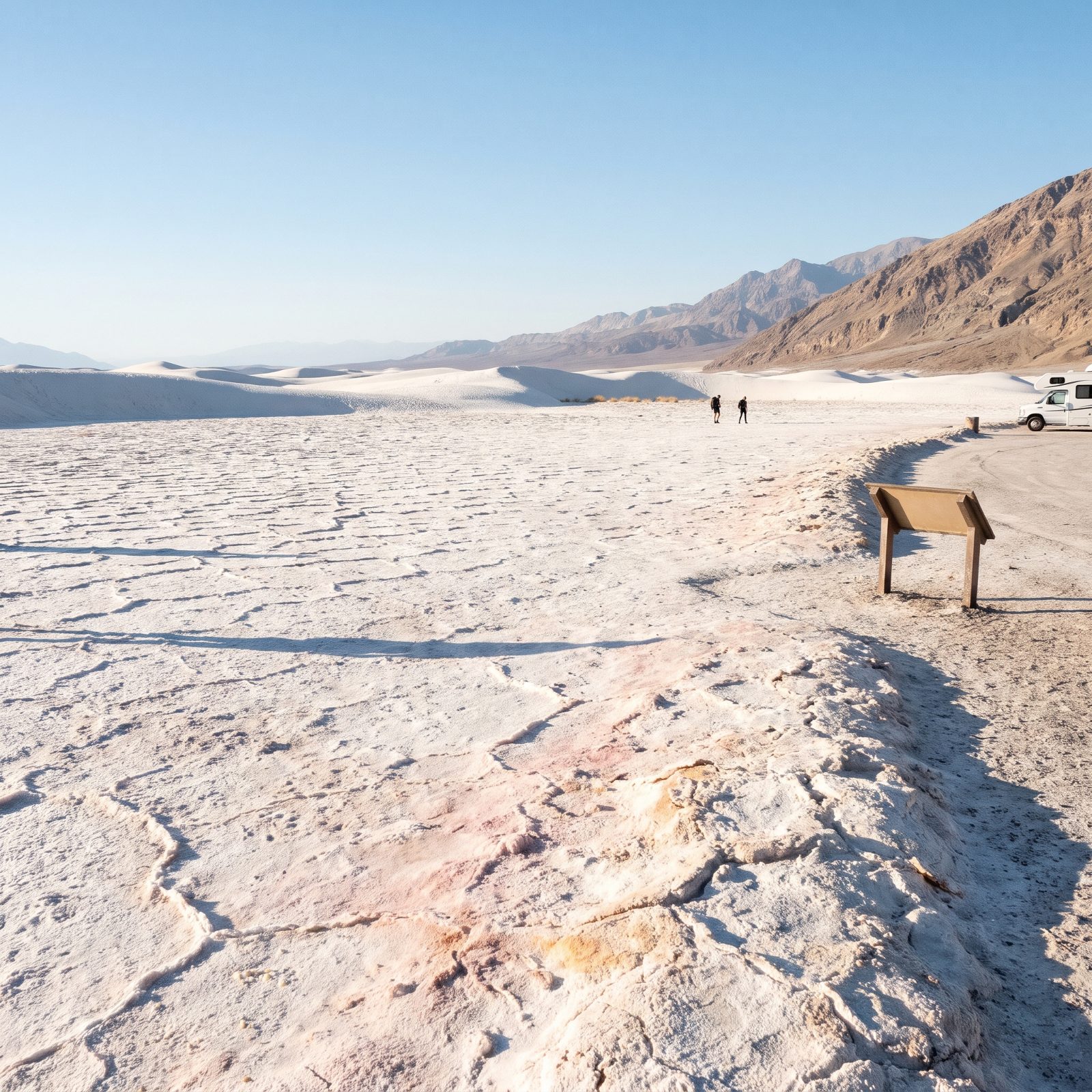
Everyone shoots Guadalupe Peak and calls it a day. Drive the long way around to the western side and you hit the Salt Basin Dunes, a sheet of white gypsum that looks like someone spilled White Sands by accident in the Chihuahuan Desert.
Here’s the honest part. The access road runs remote, the parking is a gravel lot, and there’s not a hookup for miles, so treat this as a day-use detour rather than somewhere you overnight in the rig. Bring more water than you think. That white ground throws heat straight back up at you, and we’ve watched people badly underestimate the walk.
9. Mammoth Cave’s Green Sinkholes and Surface Rivers That Nobody Goes Down To See
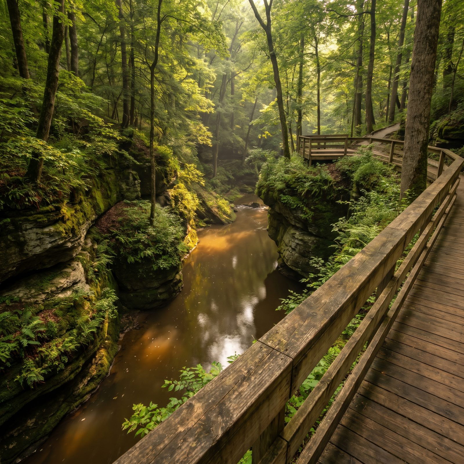
The whole park sells the underground. Fair enough — it’s the longest cave system on Earth. But most visitors never look at the surface that made the cave, and that’s a shame.
Above ground, Mammoth is a landscape of sinkholes, disappearing streams, and the slow brown Green River cutting through limestone. Those sinkholes are deep, fern-filled bowls where whole forests grow below road level. Drive the park loops, pull off at the overlooks, and you’ll catch the sky reflected in water that vanishes underground a mile later.
The developed campground near the visitor center handles RVs fine — no hookups, but decent pull-throughs. Book ahead in summer. It fills.
8. Theodore Roosevelt’s Petrified Forest, Where the Badlands Hide Ancient Stumps
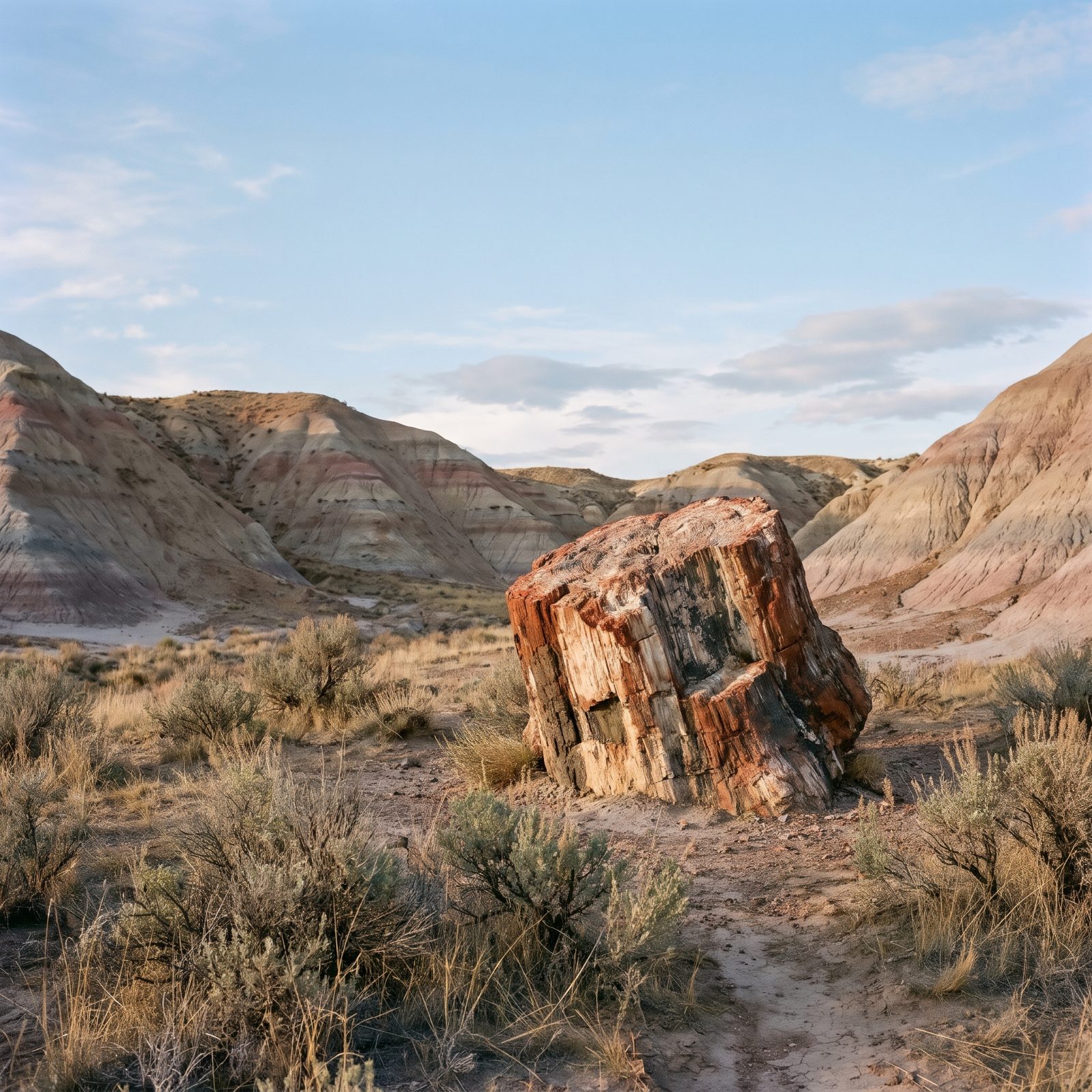
Ask anyone about this park and they’ll say bison and badlands. Both true. But the South Unit holds one of the largest concentrations of petrified wood in the country, and almost nobody hikes out to it.
The Petrified Forest Loop is a real walk — several miles through open badlands with little shade, which makes it a cooler-weather, early-start kind of trip. Out there you find entire fossilized stumps, ancient trees turned to banded stone, scattered across the clay like a scene that stopped mid-sentence.
7. Indiana Dunes’ Floating Bog, the Wetland That Shares a Park With the Beach
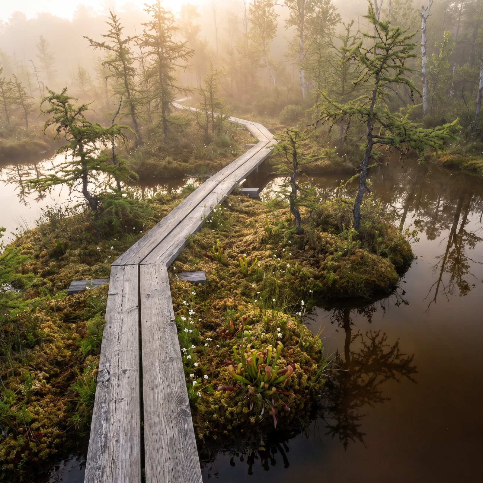
The name promises sand. The shoreline delivers. Drive ten minutes inland, though, and Indiana Dunes becomes something else entirely — a stitched-together patchwork of marsh, bog, and black oak savanna that holds more plant diversity per acre than almost any park its size.
Pinhook Bog is the one to find. A floating mat of sphagnum moss and tamarack, leftover from the last ice age, home to carnivorous pitcher plants. The ground literally bounces underfoot. Access is limited and often by permit, so check before you go.
The campground sits over on the beach side with electric hookups, which is rare and welcome for a park this close to Chicago.
6. Hawaiʻi Volcanoes’ Rainforest Lava Tube, Green on the Outside, Black Within
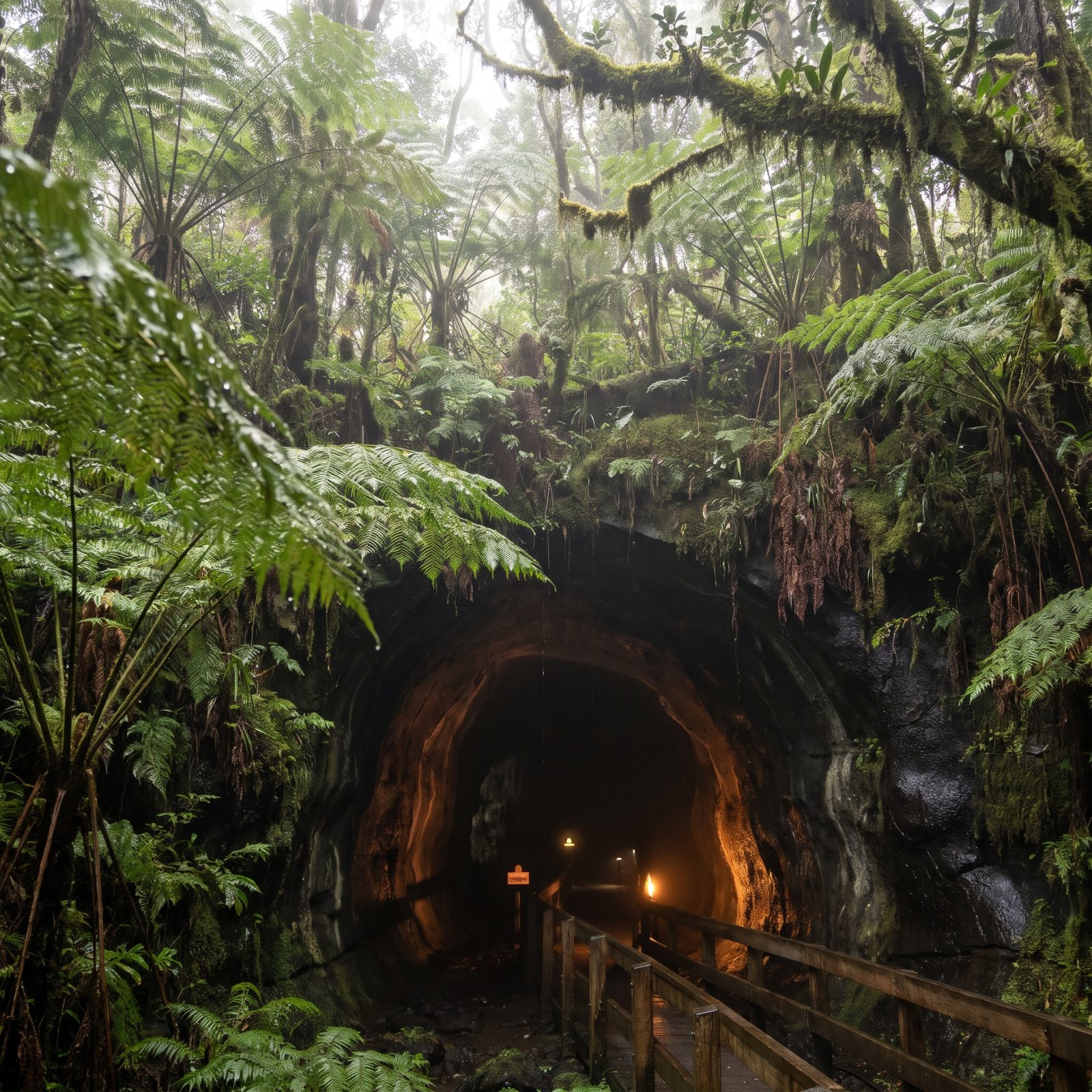
You come for lava. Glowing craters, steam vents, the whole fire-and-brimstone pitch. What catches people off guard is the rainforest.
The Nāhuku lava tube — also called Thurston — sits inside a jungle of giant tree ferns so dense it feels tropical the second you step out of the car. You walk from that dripping green world into a smooth black tunnel carved by lava centuries ago, cool and quiet, lit just enough to see your feet.
It’s a short, accessible walk off the Crater Rim Drive, one of the easiest surprises in the park. Nearby Nāmakanipaio Campground takes RVs — basic sites, cool elevation, a good base away from the crater crowds.
5. Virgin Islands’ Sugar-Plantation Ruins Buried in the Jungle Above the Beach
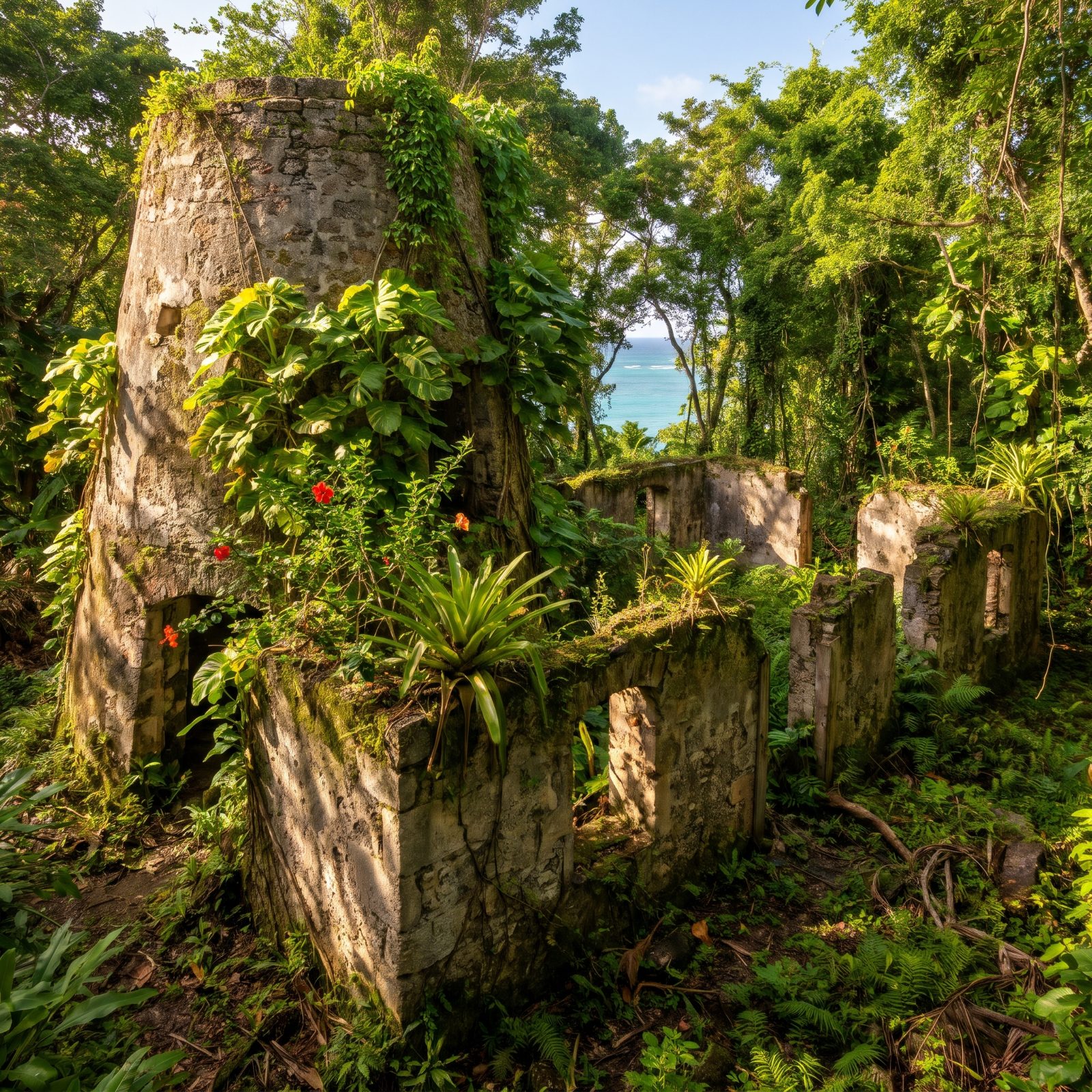
The brochures are all water. That impossible turquoise, the white sand, the snorkeling — all real, all worth it. Climb a little into the hills behind the beaches, though, and you hit something the postcards leave out entirely.
Scattered across St. John are the ruins of sugar plantations, stone windmills and boiling houses slowly losing to the jungle. The Annaberg ruins are the most complete, with a windmill tower and interpretive signs that tell the harder history of how this place was actually built — by enslaved people, under brutal conditions.
4. Isle Royale’s Lonely Lighthouses and the Shipwreck Coast Nobody Reaches
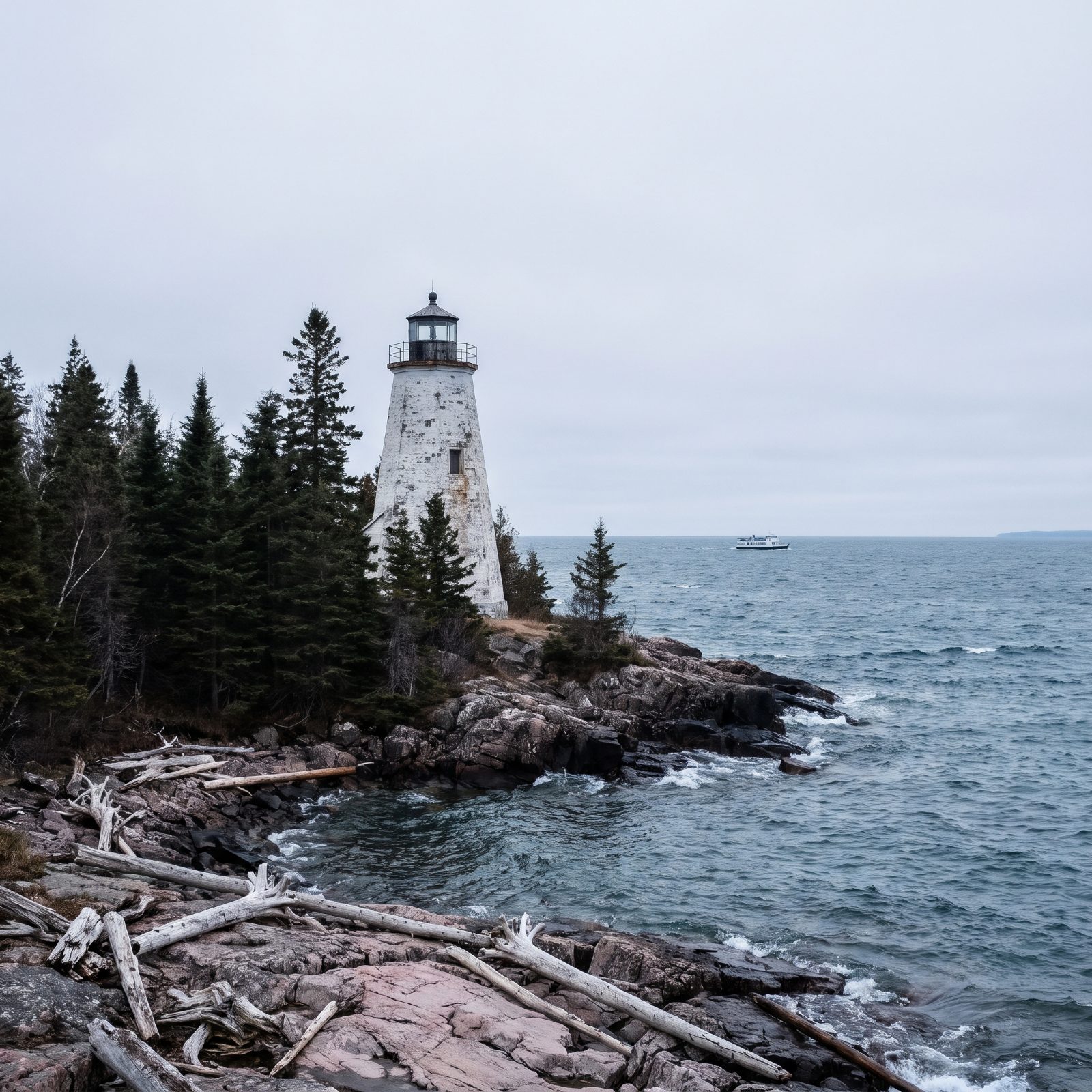
No roads. No cars. No RVs. This one breaks the rules of the whole list, and that’s exactly the point.
Isle Royale is the least-visited national park in the lower 48, a wild island in Lake Superior you reach only by ferry or seaplane. Its shoreline is studded with historic lighthouses and the bones of shipwrecks — the lake has claimed plenty of vessels on these reefs over the years. The water is brutally cold and crystal clear.
You’ll park the rig on the mainland in Houghton or Grand Portage and cross by ferry or seaplane. Treat it as the trip you take when you want to feel genuinely far from everything. It delivers.
3. Wrangell, St. Elias and the Rust-Red Kennecott Mill Clinging to the Mountain
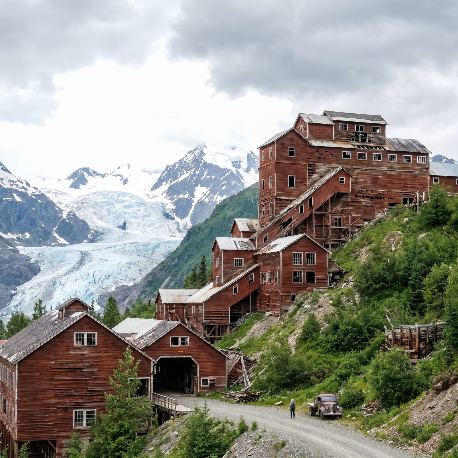
The park is bigger than Switzerland. Glaciers, volcanoes, the whole scale that makes Alaska Alaska. And tucked into all that wilderness sits one of the strangest buildings in the national park system.
The Kennecott mill is a 14-story wooden ghost painted that unmistakable rust red, stacked down a mountainside above a glacier. It processed copper a century ago, then emptied out almost overnight when the ore ran dry. Walking its tilting floors, you’d swear the workers stepped out for lunch and never came back.
2. Pinnacles’ Dark Talus Caves, Cave Country Without the Caving
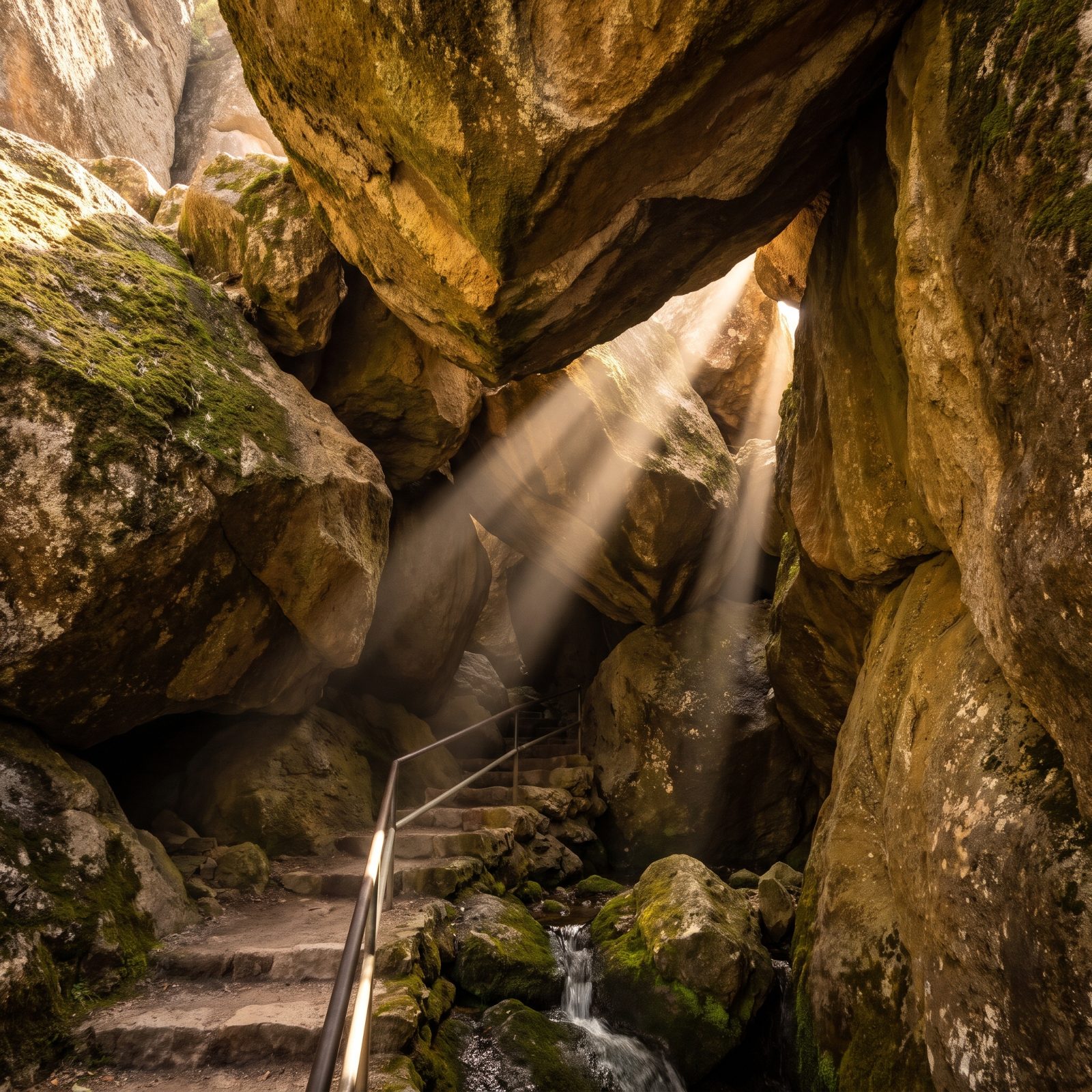
Most people picture the spires — those eroded rock towers that give the park its name, popular with climbers and condor-watchers. The caves barely make the brochure, and they’re the best-kept secret here.
Pinnacles has talus caves, not carved by water but formed when giant boulders tumbled into narrow canyons and roofed them over. You scramble through cool, dark passages with a headlamp while daylight stabs down through gaps overhead. Bats roost in some sections, which means parts close seasonally. Check before you go.
The east-side campground takes RVs and even has a pool — a genuinely welcome thing after a hot central-California hike.
1. Mesa Verde’s Cliff Dwellings Hushed Under a Blanket of Winter Snow
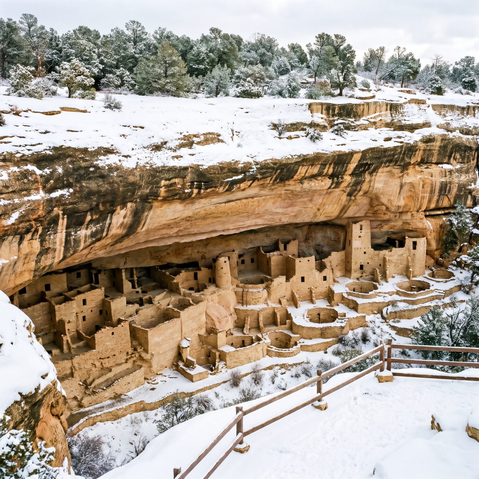
The famous shot is Cliff Palace in full summer sun, packed shoulder to shoulder with tour groups. Come back in winter and the whole place changes character.
Snow settles on the alcoves and the centuries-old stone rooms go quiet. The crowds vanish. You can stand at an overlook in cold, clear air with the canyon to yourself and finally feel the weight of what you’re looking at — homes built into cliffs eight centuries ago.
The catch is access. Ranger-guided tours and some roads shut down for the season, so you’re mostly looking from overlooks. Morefield Campground closes in winter too, which means basing in nearby Cortez or Mancos and driving in. Worth every mile of the detour.